


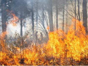
Researchers from Oak Ridge National Laboratory and Northeastern University modeled how extreme conditions in a changing climate affect the land’s ability to absorb atmospheric carbon — a key process for mitigating human-caused emissions. They found that 88% of Earth’s regions could become carbon emitters by the end of the 21st century.
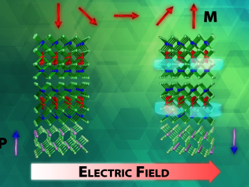
An advance in a topological insulator material — whose interior behaves like an electrical insulator but whose surface behaves like a conductor — could revolutionize the fields of next-generation electronics and quantum computing, according to scientists at ORNL.

Gang Seob “GS” Jung has known from the time he was in middle school that he was interested in science.

An international problem like climate change needs solutions that cross boundaries, both on maps and among disciplines. Oak Ridge National Laboratory computational scientist Deeksha Rastogi embodies that approach.

A new tool from Oak Ridge National Laboratory can help planners, emergency responders and scientists visualize how flood waters will spread for any scenario and terrain.

A novel approach developed by scientists at ORNL can scan massive datasets of large-scale satellite images to more accurately map infrastructure – such as buildings and roads – in hours versus days.

A team of scientists led by Oak Ridge National Laboratory used machine learning methods to generate a high-resolution map of vegetation growing in the remote reaches of the Alaskan tundra.

The field of “Big Data” has exploded in the blink of an eye, growing exponentially into almost every branch of science in just a few decades. Sectors such as energy, manufacturing, healthcare and many others depend on scalable data processing and analysis for continued in...