-
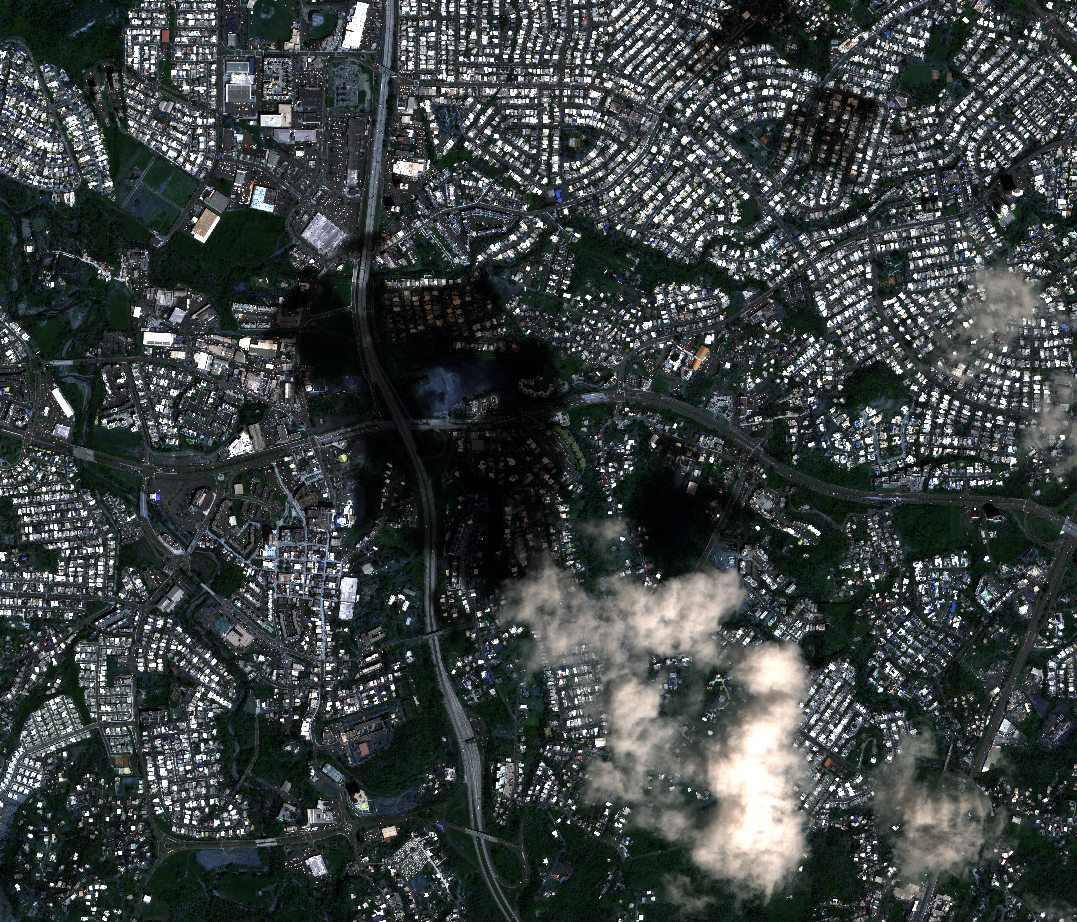
A new computational approach by ORNL can more quickly scan large-scale satellite images, such as these of Puerto Rico, for more accurate mapping of complex infrastructure. Credit: Maxar Technologies and Dalton Lunga/Oak Ridge National Laboratory, U.S. Dept. of Energy
-
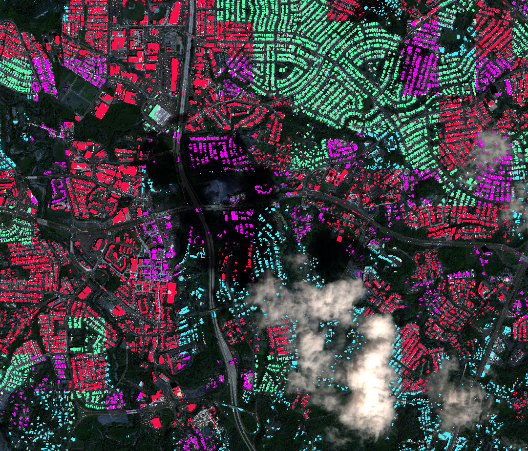
A new computational approach by ORNL can more quickly scan large-scale satellite images, such as these of Puerto Rico, for more accurate mapping of complex infrastructure like buildings.
Credit: Maxar Technologies and Dalton Lunga/Oak Ridge National Laboratory, U.S. Dept. of Energy


-
A new computational approach by ORNL can more quickly scan large-scale satellite images, such as these of Puerto Rico, for more accurate mapping of complex infrastructure. Credit: Maxar Technologies and Dalton Lunga/Oak Ridge National Laboratory, U.S. Dept. of Energy
-
A new computational approach by ORNL can more quickly scan large-scale satellite images, such as these of Puerto Rico, for more accurate mapping of complex infrastructure like buildings.
Credit: Maxar Technologies and Dalton Lunga/Oak Ridge National Laboratory, U.S. Dept. of Energy
A novel approach developed by scientists at Oak Ridge National Laboratory can scan massive datasets of large-scale satellite images to more accurately map infrastructure – such as buildings and roads – in hours versus days.
Comprehensive image data is useful for stakeholders to make informed decisions. The new computational workflow uses deep learning techniques to train and deploy models to better address location, environmental and time challenges when mapping structures.
“We developed a framework that divides the labor of characterization among several models, each tasked to learn to detect specific objects under near-homogeneous contexts versus one model attempting to detect objects under diverse conditions across a collection of images,” said ORNL’s Dalton Lunga who led the study.
The team tested the approach on 21 terabytes-worth of image data (one terabyte covers about 12,085 square miles) and reduced the computing time from 28 days to about 21 hours.
Next, they will characterize even larger image datasets on ORNL’s Summit supercomputer.

