ORNL will use its land surface modeling tools to determine Baltimore’s climate risk and analyze green infrastructure improvements that can help mitigate impacts on underserved communities as part of a DOE Urban Integrated Field Laboratory project. Source: Google Earth, accessed Sept. 12, 2022

ORNL researchers are deploying their broad expertise in climate data and modeling to create science-based mitigation strategies for cities stressed by climate change as part of two U.S. Department of Energy Urban Integrated Field Laboratory projects.

Researchers used quantum Monte Carlo calculations to accurately render the structure and electronic properties of germanium selenide, a semiconducting nanomaterial. Credit: Paul Kent/ORNL, U.S. Dept. of Energy

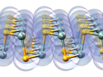
A multi-lab research team led by ORNL's Paul Kent is developing a computer application called QMCPACK to enable precise and reliable predictions of the fundamental properties of materials critical in energy research.

The Energy Exascale Earth System Model project reliably simulates aspects of earth system variability and projects decadal changes that will critically impact the U.S. energy sector in the future. A new version of the model delivers twice the performance of its predecessor. Credit: E3SM, Dept. of Energy

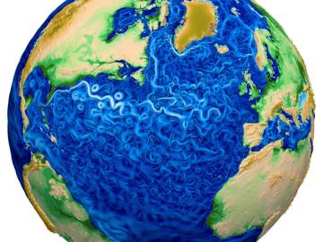
A new version of the Energy Exascale Earth System Model, or E3SM, is two times faster than an earlier version released in 2018.

The CrossVis application includes a parallel coordinates plot (left), a tiled image view (right) and other interactive data views. Credit: Chad Steed/Oak Ridge National Laboratory, U.S. Dept. of Energy

From materials science and earth system modeling to quantum information science and cybersecurity, experts in many fields run simulations and conduct experiments to collect the abundance of data necessary for scientific progress.

A new computational approach by ORNL can more quickly scan large-scale satellite images, such as these of Puerto Rico, for more accurate mapping of complex infrastructure like buildings. Credit: Maxar Technologies and Dalton Lunga/Oak Ridge National Laboratory, U.S. Dept. of Energy

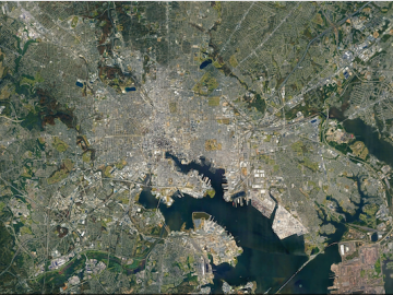
A novel approach developed by scientists at ORNL can scan massive datasets of large-scale satellite images to more accurately map infrastructure – such as buildings and roads – in hours versus days. 

ORNL-developed cryogenic memory cell circuit designs fabricated onto these small chips by SeeQC, a superconducting technology company, successfully demonstrated read, write and reset memory functions. Credit: Carlos Jones/Oak Ridge National Laboratory, U.S. Dept. of Energy

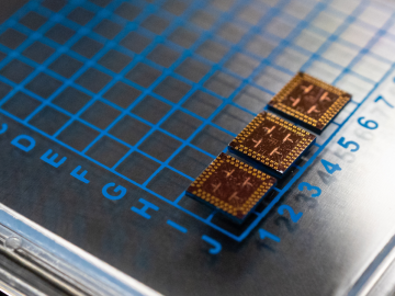
Scientists at have experimentally demonstrated a novel cryogenic, or low temperature, memory cell circuit design based on coupled arrays of Josephson junctions, a technology that may be faster and more energy efficient than existing memory devices.