


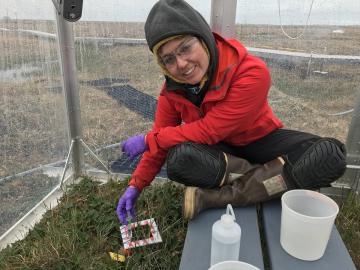
While some of her earth system modeling colleagues at ORNL face challenges such as processor allocation or debugging code, Verity Salmon prepares for mosquito swarms and the possibility of grizzly bears.

A novel approach developed by scientists at ORNL can scan massive datasets of large-scale satellite images to more accurately map infrastructure – such as buildings and roads – in hours versus days.
Oak Ridge National Laboratory will partner with Cincinnati Children’s Hospital Medical Center to explore ways to deploy expertise in health data science that could more quickly identify patients’ mental health risk factors and aid in
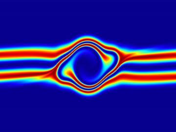
The prospect of simulating a fusion plasma is a step closer to reality thanks to a new computational tool developed by scientists in fusion physics, computer science and mathematics at ORNL.

A typhoon strikes an island in the Pacific Ocean, downing power lines and cell towers. An earthquake hits a remote mountainous region, destroying structures and leaving no communication infrastructure behind.