
News

ORNL, VA and Harvard researchers developed a sparse matrix full of anonymized information on what is thought to be the largest cohort of healthcare data used for this type of research in the U.S. The matrix can be probed with different methods, such as KESER, to gain new insights into human health. Credit: Nathan Armistead/ORNL, U.S. Dept. of Energy

A team of researchers has developed a novel, machine learning–based  technique to explore and identify relationships among medical concepts using electronic health record data across multiple healthcare providers.

Summer Widner, Stephanie Timbs, James Gaugler and James Avenell of ORNL are part of a team that processes thorium-228, a byproduct of actinium-227. As new uses for thorium are realized, particularly in medicine, the lab expects the demand for the radioisotope to grow.

As a medical isotope, thorium-228 has a lot of potential — and Oak Ridge National Laboratory produces a lot.

ORNL Image

An analysis published in the Proceedings of the National Academy of Sciences and led by researchers from the U.S. Department of Energy’s Oak Ridge National Laboratory has received the 2021 Sustainability Science Award from the Ecological Society of America.

Targeted alpha therapy can deliver radiation to specific cells, with minimal effect on surrounding, healthy cells. Credit: Michelle Lehman and Jaimee Janiga/ORNL, U.S. Dept. of Energy

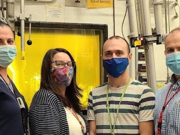
A rare isotope in high demand for treating cancer is now more available to pharmaceutical companies developing and testing new drugs.

Sandra Davern performs cell based assays to evaluate cell death and DNA damage in response to radiation in order to gain a better understanding of how radioisotope nanoparticles affect the human body.

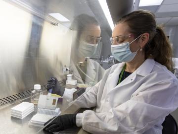
When Sandra Davern looks to the future, she sees individualized isotopes sent into the body with a specific target: cancer cells.

A new computational approach by ORNL can more quickly scan large-scale satellite images, such as these of Puerto Rico, for more accurate mapping of complex infrastructure like buildings. Credit: Maxar Technologies and Dalton Lunga/Oak Ridge National Laboratory, U.S. Dept. of Energy

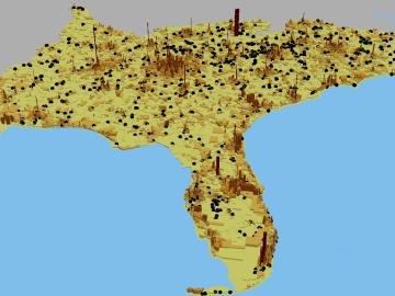
A novel approach developed by scientists at ORNL can scan massive datasets of large-scale satellite images to more accurately map infrastructure – such as buildings and roads – in hours versus days.