Filter News
Area of Research
- (-) Electricity and Smart Grid (1)
- (-) National Security (4)
- (-) Nuclear Science and Technology (1)
- Advanced Manufacturing (4)
- Biology and Environment (11)
- Building Technologies (2)
- Clean Energy (36)
- Computational Biology (1)
- Computational Engineering (1)
- Computer Science (6)
- Energy Sciences (1)
- Fusion and Fission (2)
- Fusion Energy (6)
- Materials (6)
- Materials for Computing (4)
- Quantum information Science (1)
- Sensors and Controls (1)
- Supercomputing (7)
News Topics
- (-) Coronavirus (1)
- (-) Fusion (1)
- (-) Grid (3)
- (-) Summit (1)
- (-) Sustainable Energy (1)
- Advanced Reactors (4)
- Big Data (2)
- Biomedical (1)
- Computer Science (2)
- Cybersecurity (1)
- Energy Storage (1)
- Environment (1)
- Isotopes (1)
- Molten Salt (3)
- Neutron Science (2)
- Nuclear Energy (10)
- Security (1)
- Space Exploration (2)
- Transportation (1)
Media Contacts
![ORNL researchers are developing a method to print low-cost, high-fidelity, customizable sensors for monitoring power grid equipment. Credit: Carlos Jones/ORNL, U.S. Dept. of Energy](/sites/default/files/styles/list_page_thumbnail/public/2021-02/SAW%20sensors%202021-P01084_0.jpg?h=8f9cfe54&itok=H3Fe6A_G)
A method developed at Oak Ridge National Laboratory to print high-fidelity, passive sensors for energy applications can reduce the cost of monitoring critical power grid assets.
![GIS – LandScan goes public](/sites/default/files/styles/list_page_thumbnail/public/2020-05/sanfran%20%281%29_2.png?h=ea18fbc4&itok=c_VbFqAC)
Oak Ridge National Laboratory’s high-resolution population distribution database, LandScan USA, became permanently available to researchers in time to aid the response to the novel coronavirus pandemic.
![A new computational approach by ORNL can more quickly scan large-scale satellite images, such as these of Puerto Rico, for more accurate mapping of complex infrastructure like buildings. Credit: Maxar Technologies and Dalton Lunga/Oak Ridge National Laboratory, U.S. Dept. of Energy](/sites/default/files/styles/list_page_thumbnail/public/2020-02/Puerto_Rico_Resflow9.png?h=a0a1befd&itok=5n2fss_e)
A novel approach developed by scientists at ORNL can scan massive datasets of large-scale satellite images to more accurately map infrastructure – such as buildings and roads – in hours versus days.
![Smart Neighborhood homes](/sites/default/files/styles/list_page_thumbnail/public/2020-01/04.09.TD-SMartHome_0.jpg?h=5b5a5437&itok=22S5Tle1)
To better determine the potential energy cost savings among connected homes, researchers at Oak Ridge National Laboratory developed a computer simulation to more accurately compare energy use on similar weather days.
![Argon pellet injection text](/sites/default/files/styles/list_page_thumbnail/public/2019-11/13966_Ar_20degree_enhanced_0.jpg?h=8450e950&itok=tmff0GX_)
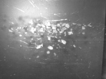
As scientists study approaches to best sustain a fusion reactor, a team led by Oak Ridge National Laboratory investigated injecting shattered argon pellets into a super-hot plasma, when needed, to protect the reactor’s interior wall from high-energy runaway electrons.
![As part of a preliminary study, ORNL scientists used critical location data collected from Twitter to map the location of certain power outages across the United States.](/sites/default/files/styles/list_page_thumbnail/public/2019-02/PowerOutageTweets_map_0.png?h=6448fdc1&itok=AUit-O2Y)
Gleaning valuable data from social platforms such as Twitter—particularly to map out critical location information during emergencies— has become more effective and efficient thanks to Oak Ridge National Laboratory.