
Tackling the climate crisis and achieving an equitable clean energy future are among the biggest challenges of our time.
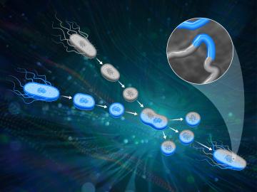
ORNL scientists had a problem mapping the genomes of bacteria to better understand the origins of their physical traits and improve their function for bioenergy production.
Using novel data sets and computing systems, researchers at ORNL are simulating how climate change affects the safety and security of the country.
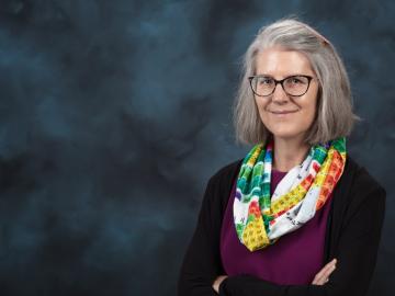
Deborah Frincke, one of the nation’s preeminent computer scientists and cybersecurity experts, serves as associate laboratory director of ORNL’s National Security Science Directorate. Credit: Carlos Jones/ORNL, U.S. Dept. of Energy
As Hurricane Dorian raged through the Bahamas, researchers at Oak Ridge National Laboratory worked around the clock to aid recovery efforts for one of the Caribbean’s worst storms ever.

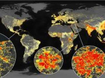
A novel approach developed by scientists at ORNL can scan massive datasets of large-scale satellite images to more accurately map infrastructure – such as buildings and roads – in hours versus days.