ORNL researchers are establishing a digital thread of data, algorithms and workflows to produce a continuously updated model of earth systems.

Digital twins are exactly what they sound like: virtual models of physical reality that continuously update to reflect changes in the real world.


Sam Hollifield displays a prototype of the Secure Hijack, Intrusion and Exploit Layered Detector, or SHIELD, the device monitoring the cybersecurity of the semi-truck. Credit: Lena Shoemaker/ORNL, U.S. Dept. of Energy

As vehicles gain technological capabilities, car manufacturers are using an increasing number of computers and sensors to improve situational awareness and enhance the driving experience.

LandScan Global depicts population distribution estimates across the planet. The darker orange and red colors above indicate higher population density. Credit: ORNL, U.S. Dept. of Energy

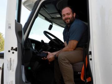
It’s a simple premise: To truly improve the health, safety, and security of human beings, you must first understand where those individuals are.

ORNL, VA and Harvard researchers developed a sparse matrix full of anonymized information on what is thought to be the largest cohort of healthcare data used for this type of research in the U.S. The matrix can be probed with different methods, such as KESER, to gain new insights into human health. Credit: Nathan Armistead/ORNL, U.S. Dept. of Energy

A team of researchers has developed a novel, machine learning–based  technique to explore and identify relationships among medical concepts using electronic health record data across multiple healthcare providers.

A selfie from the Curiosity rover as it explores the surface of Mars. Like many spacecraft, Curiosity uses a radioisotope power system to help fuel its mission. Credit: NASA/JPL-Caltech/MSSS

Radioactive isotopes power some of NASA’s best-known spacecraft. But predicting how radiation emitted from these isotopes might affect nearby materials is tricky

Pu-238 pellet drawing

After its long journey to Mars beginning this summer, NASA’s Perseverance rover will be powered across the planet’s surface in part by plutonium produced at the Department of Energy’s Oak Ridge National Laboratory.

The CrossVis application includes a parallel coordinates plot (left), a tiled image view (right) and other interactive data views. Credit: Chad Steed/Oak Ridge National Laboratory, U.S. Dept. of Energy

From materials science and earth system modeling to quantum information science and cybersecurity, experts in many fields run simulations and conduct experiments to collect the abundance of data necessary for scientific progress.

Solid radium sulfate sits in the bottom of a flask during the recovery process. Credit: Oak Ridge National Laboratory, U.S. Dept. of Energy

Oak Ridge National Laboratory researchers have discovered a better way to separate actinium-227, a rare isotope essential for an FDA-approved cancer treatment.

A new computational approach by ORNL can more quickly scan large-scale satellite images, such as these of Puerto Rico, for more accurate mapping of complex infrastructure like buildings. Credit: Maxar Technologies and Dalton Lunga/Oak Ridge National Laboratory, U.S. Dept. of Energy

A novel approach developed by scientists at ORNL can scan massive datasets of large-scale satellite images to more accurately map infrastructure – such as buildings and roads – in hours versus days. 

As part of a preliminary study, ORNL scientists used critical location data collected from Twitter to map the location of certain power outages across the United States.

Gleaning valuable data from social platforms such as Twitter—particularly to map out critical location information during emergencies— has become more effective and efficient thanks to Oak Ridge National Laboratory.