Filter News
Area of Research
News Type
Media Contacts
![Researchers used the open-source Community Earth System Model to simulate the effects that extreme climatic conditions have on processes like land carbon storage. Credit: Carlos Jones/ORNL, U.S. Dept. of Energy](/sites/default/files/styles/list_page_thumbnail/public/2023-09/wildfire_0.jpg?h=175bab9e&itok=sbjoOQiV)
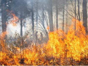
Researchers from Oak Ridge National Laboratory and Northeastern University modeled how extreme conditions in a changing climate affect the land’s ability to absorb atmospheric carbon — a key process for mitigating human-caused emissions. They found that 88% of Earth’s regions could become carbon emitters by the end of the 21st century.
![Ashley Barker. Credit: Carlos Jones/ORNL](/sites/default/files/styles/list_page_thumbnail/public/2023-05/2022-P14022.jpg?h=c6980913&itok=Su1w1TDa)
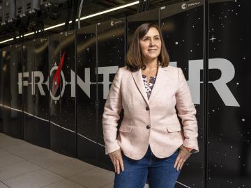
At the National Center for Computational Sciences, Ashley Barker enjoys one of the least complicated–sounding job titles at ORNL: section head of operations. But within that seemingly ordinary designation lurks a multitude of demanding roles as she oversees the complete user experience for NCCS computer systems.
![Deeksha Rastogi uses high-performance computing to understand the human impacts of climate change. Credit: Carlos Jones, ORNL/U.S. Dept. of Energy](/sites/default/files/styles/list_page_thumbnail/public/2021-09/2021-P06173_0.jpg?h=6881dff6&itok=IbKJui6N)
An international problem like climate change needs solutions that cross boundaries, both on maps and among disciplines. Oak Ridge National Laboratory computational scientist Deeksha Rastogi embodies that approach.
![The TRITON model provides a detailed visualization of the flooding that resulted when Hurricane Harvey stalled over Houston for four days in 2017. Credit: Mario Morales-Hernández/ORNL, U.S. Dept. of Energy](/sites/default/files/styles/list_page_thumbnail/public/2021-01/TRITON%20screenshot.png?h=4a7d1ed4&itok=IEra5eDk)
A new tool from Oak Ridge National Laboratory can help planners, emergency responders and scientists visualize how flood waters will spread for any scenario and terrain.