Filter News
Area of Research
News Topics
- (-) Environment (1)
- (-) Isotopes (1)
- (-) Nanotechnology (1)
- (-) Neutron Science (1)
- Advanced Reactors (2)
- Big Data (1)
- Biomedical (1)
- Computer Science (2)
- Coronavirus (1)
- Energy Storage (3)
- Grid (1)
- Materials Science (6)
- Microscopy (2)
- Molten Salt (1)
- Nuclear Energy (3)
- Polymers (2)
- Summit (1)
- Sustainable Energy (2)
- Transportation (1)
Media Contacts
![ORNL’s Lab-on-a-crystal uses machine learning to correlate materials’ mechanical, optical and electrical responses to dynamic environments. Credit: Ilia Ivanov/ORNL, U.S. Dept. of Energy](/sites/default/files/styles/list_page_thumbnail/public/2020-08/lab_on_crystal2_0.png?h=bc215d7c&itok=5Zsjkf9e)
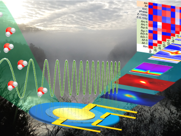
An all-in-one experimental platform developed at Oak Ridge National Laboratory’s Center for Nanophase Materials Sciences accelerates research on promising materials for future technologies.
![Solid radium sulfate sits in the bottom of a flask during the recovery process. Credit: Oak Ridge National Laboratory, U.S. Dept. of Energy](/sites/default/files/styles/list_page_thumbnail/public/2020-06/Ac227%202.jpg?h=479d286c&itok=AiNceGva)
Oak Ridge National Laboratory researchers have discovered a better way to separate actinium-227, a rare isotope essential for an FDA-approved cancer treatment.
![Nuclear — Seeing inside particles](/sites/default/files/styles/list_page_thumbnail/public/2020-04/Kernels-nuclear%20materials-2_0.jpg?h=ae51ec69&itok=_AWiopZz)
Oak Ridge National Laboratory researchers working on neutron imaging capabilities for nuclear materials have developed a process for seeing the inside of uranium particles – without cutting them open.
![A new computational approach by ORNL can more quickly scan large-scale satellite images, such as these of Puerto Rico, for more accurate mapping of complex infrastructure like buildings. Credit: Maxar Technologies and Dalton Lunga/Oak Ridge National Laboratory, U.S. Dept. of Energy](/sites/default/files/styles/list_page_thumbnail/public/2020-02/Puerto_Rico_Resflow9.png?h=a0a1befd&itok=5n2fss_e)
A novel approach developed by scientists at ORNL can scan massive datasets of large-scale satellite images to more accurately map infrastructure – such as buildings and roads – in hours versus days.