


Combining expertise in physics, applied math and computing, Oak Ridge National Laboratory scientists are expanding the possibilities for simulating electromagnetic fields that underpin phenomena in materials design and telecommunications.
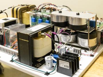
ORNL researchers have developed an intelligent power electronic inverter platform that can connect locally sited energy resources such as solar panels, energy storage and electric vehicles and smoothly interact with the utility power grid.

From materials science and earth system modeling to quantum information science and cybersecurity, experts in many fields run simulations and conduct experiments to collect the abundance of data necessary for scientific progress.
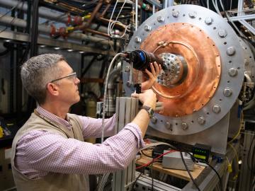
Temperatures hotter than the center of the sun. Magnetic fields hundreds of thousands of times stronger than the earth’s. Neutrons energetic enough to change the structure of a material entirely.
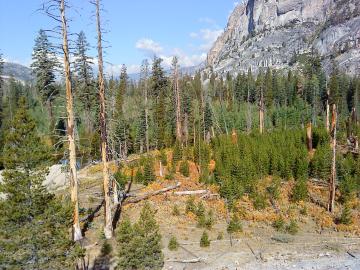
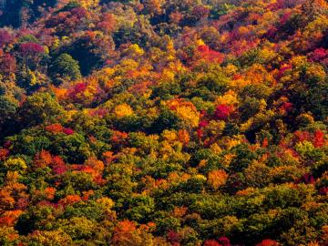
A multi-institutional research team found that changing environmental conditions are affecting forests around the globe, leading to increasing tree death and uncertainty about the ability of forests to recover.
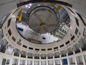
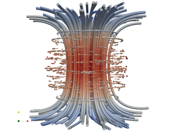
ITER, the world’s largest international scientific collaboration, is beginning assembly of the fusion reactor tokamak that will include 12 different essential hardware systems provided by US ITER, which is managed by Oak Ridge National Laboratory.
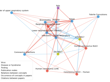
Scientists have tapped the immense power of the Summit supercomputer at Oak Ridge National Laboratory to comb through millions of medical journal articles to identify potential vaccines, drugs and effective measures that could suppress or stop the

In the race to identify solutions to the COVID-19 pandemic, researchers at the Department of Energy’s Oak Ridge National Laboratory are joining the fight by applying expertise in computational science, advanced manufacturing, data science and neutron science.

A novel approach developed by scientists at ORNL can scan massive datasets of large-scale satellite images to more accurately map infrastructure – such as buildings and roads – in hours versus days.