


Researchers from Oak Ridge National Laboratory and Northeastern University modeled how extreme conditions in a changing climate affect the land’s ability to absorb atmospheric carbon — a key process for mitigating human-caused emissions. They found that 88% of Earth’s regions could become carbon emitters by the end of the 21st century.

A new report published by ORNL assessed how advanced manufacturing and materials, such as 3D printing and novel component coatings, could offer solutions to modernize the existing fleet and design new approaches to hydropower.
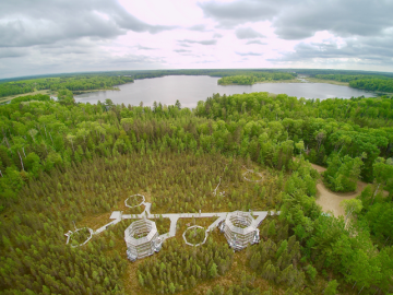
Oak Ridge National Laboratory scientists evaluating northern peatland responses to environmental change recorded extraordinary fine-root growth with increasing temperatures, indicating that this previously hidden belowground mechanism may play an important role in how carbon-rich peatlands respond to warming.
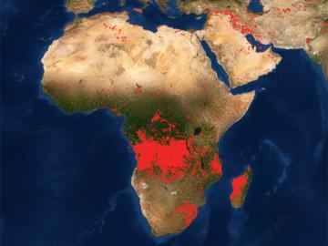
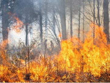
Researchers at Oak Ridge National Laboratory developed a method that uses machine learning to predict seasonal fire risk in Africa, where half of the world’s wildfire-related carbon emissions originate.
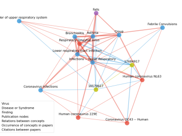
Scientists have tapped the immense power of the Summit supercomputer at Oak Ridge National Laboratory to comb through millions of medical journal articles to identify potential vaccines, drugs and effective measures that could suppress or stop the

An international team of scientists found that rules governing plant growth hold true even at the edges of the world in the Arctic tundra.

A novel approach developed by scientists at ORNL can scan massive datasets of large-scale satellite images to more accurately map infrastructure – such as buildings and roads – in hours versus days.