Filter News
Area of Research
- (-) Computer Science (1)
- (-) National Security (5)
- Advanced Manufacturing (1)
- Biology and Environment (7)
- Clean Energy (13)
- Fusion and Fission (1)
- Fusion Energy (4)
- Materials (4)
- Materials for Computing (2)
- Neutron Science (8)
- Nuclear Science and Technology (3)
- Nuclear Systems Modeling, Simulation and Validation (1)
- Supercomputing (16)
Media Contacts
![Six ORNL scientists have been elected as fellows to the American Association for the Advancement of Science, or AAAS. Credit: ORNL, U.S. Dept. of Energy](/sites/default/files/styles/list_page_thumbnail/public/2020-11/AAASfellows.jpg?h=d761c044&itok=opKRkA17)
Six ORNL scientists have been elected as fellows to the American Association for the Advancement of Science, or AAAS.
![Andrew Harter, pictured, and fellow ORNL staff members formed Horizon31 to build a set of products and services that provide customized unmanned vehicle control systems. Credit: Carlos Jones/ORNL, U.S. Dept. of Energy](/sites/default/files/styles/list_page_thumbnail/public/2020-08/2018-P09718_0.jpg?h=dd220a27&itok=n2MR7GK5)
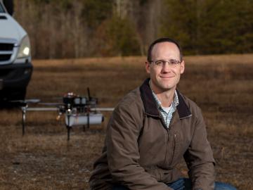
Horizon31, LLC has exclusively licensed a novel communication system that allows users to reliably operate unmanned vehicles such as drones from anywhere in the world using only an internet connection.
![GIS – LandScan goes public](/sites/default/files/styles/list_page_thumbnail/public/2020-05/sanfran%20%281%29_2.png?h=ea18fbc4&itok=c_VbFqAC)
Oak Ridge National Laboratory’s high-resolution population distribution database, LandScan USA, became permanently available to researchers in time to aid the response to the novel coronavirus pandemic.
![A new computational approach by ORNL can more quickly scan large-scale satellite images, such as these of Puerto Rico, for more accurate mapping of complex infrastructure like buildings. Credit: Maxar Technologies and Dalton Lunga/Oak Ridge National Laboratory, U.S. Dept. of Energy](/sites/default/files/styles/list_page_thumbnail/public/2020-02/Puerto_Rico_Resflow9.png?h=a0a1befd&itok=5n2fss_e)
A novel approach developed by scientists at ORNL can scan massive datasets of large-scale satellite images to more accurately map infrastructure – such as buildings and roads – in hours versus days.
![Smart Neighborhood homes](/sites/default/files/styles/list_page_thumbnail/public/2020-01/04.09.TD-SMartHome_0.jpg?h=5b5a5437&itok=22S5Tle1)
To better determine the potential energy cost savings among connected homes, researchers at Oak Ridge National Laboratory developed a computer simulation to more accurately compare energy use on similar weather days.