Filter News
Area of Research
- (-) Advanced Manufacturing (1)
- (-) National Security (2)
- Biology and Environment (8)
- Clean Energy (15)
- Fusion and Fission (2)
- Fusion Energy (4)
- Materials (19)
- Materials for Computing (3)
- Neutron Science (12)
- Nuclear Science and Technology (7)
- Nuclear Systems Modeling, Simulation and Validation (1)
- Quantum information Science (1)
- Supercomputing (18)
News Type
News Topics
- (-) Machine Learning (2)
- (-) Nanotechnology (1)
- (-) Summit (1)
- 3-D Printing/Advanced Manufacturing (4)
- Artificial Intelligence (2)
- Big Data (2)
- Climate Change (1)
- Computer Science (5)
- Coronavirus (1)
- Cybersecurity (3)
- Energy Storage (1)
- Environment (1)
- Grid (1)
- Materials Science (3)
- National Security (2)
- Neutron Science (2)
- Nuclear Energy (2)
- Security (3)
- Sustainable Energy (1)
- Transformational Challenge Reactor (1)
Media Contacts
![Researcher Chase Joslin uses Peregrine software to monitor and analyze a component being 3D printed at the Manufacturing Demonstration Facility at ORNL. Credit: Luke Scime/ORNL, U.S. Dept. of Energy.](/sites/default/files/styles/list_page_thumbnail/public/2020-08/Peregrine%20Chase%20Joslin_0.jpg?h=51c7b451&itok=4Hc6PNwu)
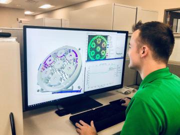
Oak Ridge National Laboratory researchers have developed artificial intelligence software for powder bed 3D printers that assesses the quality of parts in real time, without the need for expensive characterization equipment.
![The CrossVis application includes a parallel coordinates plot (left), a tiled image view (right) and other interactive data views. Credit: Chad Steed/Oak Ridge National Laboratory, U.S. Dept. of Energy](/sites/default/files/styles/list_page_thumbnail/public/2020-07/CrossVisOverview_2.png?h=fd2b4cf7&itok=Mz8wRoMo)
From materials science and earth system modeling to quantum information science and cybersecurity, experts in many fields run simulations and conduct experiments to collect the abundance of data necessary for scientific progress.
![A new computational approach by ORNL can more quickly scan large-scale satellite images, such as these of Puerto Rico, for more accurate mapping of complex infrastructure like buildings. Credit: Maxar Technologies and Dalton Lunga/Oak Ridge National Laboratory, U.S. Dept. of Energy](/sites/default/files/styles/list_page_thumbnail/public/2020-02/Puerto_Rico_Resflow9.png?h=a0a1befd&itok=5n2fss_e)
A novel approach developed by scientists at ORNL can scan massive datasets of large-scale satellite images to more accurately map infrastructure – such as buildings and roads – in hours versus days.