Filter News
Area of Research
- (-) National Security (3)
- Biology and Environment (12)
- Building Technologies (3)
- Clean Energy (40)
- Computational Biology (1)
- Computational Engineering (1)
- Computer Science (2)
- Electricity and Smart Grid (1)
- Functional Materials for Energy (1)
- Fusion and Fission (1)
- Fusion Energy (1)
- Materials (7)
- Materials for Computing (1)
- Neutron Science (6)
- Supercomputing (46)
News Type
News Topics
- (-) Buildings (1)
- (-) Summit (2)
- 3-D Printing/Advanced Manufacturing (2)
- Advanced Reactors (1)
- Artificial Intelligence (12)
- Big Data (6)
- Bioenergy (3)
- Biology (5)
- Biomedical (2)
- Biotechnology (1)
- Chemical Sciences (2)
- Climate Change (5)
- Computer Science (19)
- Coronavirus (2)
- Cybersecurity (19)
- Decarbonization (2)
- Energy Storage (2)
- Environment (5)
- Exascale Computing (1)
- Frontier (1)
- Fusion (1)
- Grid (6)
- High-Performance Computing (4)
- Machine Learning (12)
- Materials (2)
- Materials Science (3)
- Nanotechnology (1)
- National Security (34)
- Neutron Science (4)
- Nuclear Energy (5)
- Partnerships (4)
- Physics (1)
- Quantum Science (1)
- Security (11)
- Simulation (1)
- Sustainable Energy (3)
- Transportation (2)
Media Contacts
![The ORNL researchers’ findings may enable better detection of uranium tetrafluoride hydrate, a little-studied byproduct of the nuclear fuel cycle, and better understanding of how environmental conditions influence the chemical behavior of fuel cycle materials. Credit: Kevin Pastoor/Colorado School of Mines](/sites/default/files/styles/list_page_thumbnail/public/2022-05/UF4%20hydrate.png?h=d318f057&itok=spT-Dg48)
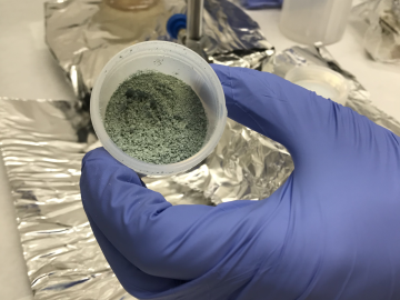
ORNL researchers used the nation’s fastest supercomputer to map the molecular vibrations of an important but little-studied uranium compound produced during the nuclear fuel cycle for results that could lead to a cleaner, safer world.
![A zoomed in view of downtown Chattanooga’s sensors, which allowed the researchers to create building occupancy schedules that could enable improved energy efficiency and faster emergency responses. Credit: Andy Berres/ORNL, U.S. Dept. of Energy](/sites/default/files/styles/list_page_thumbnail/public/2022-03/Voronoi%20View.png?h=820abd6c&itok=cesW_DEh)
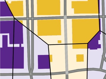
Every day, hundreds of thousands of commuters across the country travel from houses, apartments and other residential spaces to commercial buildings — from offices and schools to gyms and grocery stores.
![A new computational approach by ORNL can more quickly scan large-scale satellite images, such as these of Puerto Rico, for more accurate mapping of complex infrastructure like buildings. Credit: Maxar Technologies and Dalton Lunga/Oak Ridge National Laboratory, U.S. Dept. of Energy](/sites/default/files/styles/list_page_thumbnail/public/2020-02/Puerto_Rico_Resflow9.png?h=a0a1befd&itok=5n2fss_e)
A novel approach developed by scientists at ORNL can scan massive datasets of large-scale satellite images to more accurately map infrastructure – such as buildings and roads – in hours versus days.