
Katy Bradford: Cassette approach offers compelling construction solution
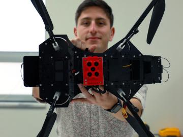
Jack Orebaugh, a forensic anthropology major at the University of Tennessee, Knoxville, has a big heart for families with missing loved ones. When someone disappears in an area of dense vegetation, search and recovery efforts can be difficult, especially when a missing person’s last location is unknown. Recognizing the agony of not knowing what happened to a family or friend, Orebaugh decided to use his internship at the Department of Energy’s Oak Ridge National Laboratory to find better ways to search for lost and deceased people using cameras and drones.
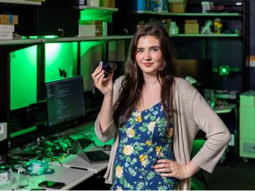
Tristen Mullins enjoys the hidden side of computers. As a signals processing engineer for ORNL, she tries to uncover information hidden in components used on the nation’s power grid — information that may be susceptible to cyberattacks.
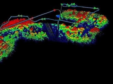
The Autonomous Systems group at ORNL is in high demand as it incorporates remote sensing into projects needing a bird’s-eye perspective.

A partnership of ORNL, the Tennessee Department of Economic and Community Development, the Community Reuse Organization of East Tennessee and TVA that aims to attract nuclear energy-related firms to Oak Ridge has been recognized with a state and local economic development award from the Federal Laboratory Consortium.

Although blockchain is best known for securing digital currency payments, researchers at the Department of Energy’s Oak Ridge National Laboratory are using it to track a different kind of exchange: It’s the first time blockchain has ever been used to validate communication among devices on the electric grid.
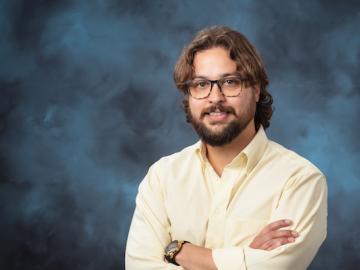
In human security research, Thomaz Carvalhaes says, there are typically two perspectives: technocentric and human centric. Rather than pick just one for his work, Carvalhaes uses data from both perspectives to understand how technology impacts the lives of people.
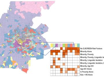
A new capability to identify urban neighborhoods, down to the block and building level, that are most vulnerable to climate change could help ensure that mitigation and resilience programs reach the people who need them the most.
Unequal access to modern infrastructure is a feature of growing cities, according to a study published this week in the Proceedings of the National Academy of Sciences
An analysis published in the Proceedings of the National Academy of Sciences and led by researchers from the U.S. Department of Energy’s Oak Ridge National Laboratory has received the 2021 Sustainability Science Award from the Ecological Society of America.

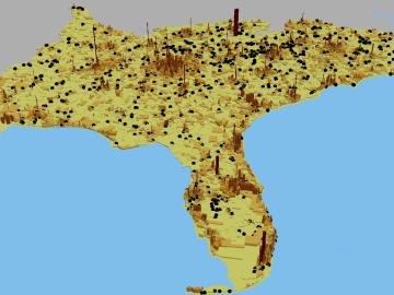
A novel approach developed by scientists at ORNL can scan massive datasets of large-scale satellite images to more accurately map infrastructure – such as buildings and roads – in hours versus days.
