Diverse evidence shows that plants and soil will likely capture and hold more carbon in response to increasing levels of carbon dioxide in the atmosphere, according to an analysis published by an international research team led by Oak Ridge National Laboratory.

Diverse evidence shows that plants and soil will likely capture and hold more carbon in response to increasing levels of carbon dioxide in the atmosphere, according to an analysis

The hybrid inverter developed by ORNL is an intelligent power electronic inverter platform that can connect locally sited energy resources such as solar panels, energy storage and electric vehicles and interact efficiently with the utility power grid. Credit: Carlos Jones, ORNL/U.S. Dept of Energy.

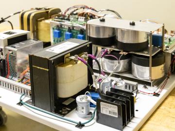
ORNL researchers have developed an intelligent power electronic inverter platform that can connect locally sited energy resources such as solar panels, energy storage and electric vehicles and smoothly interact with the utility power grid.

The CrossVis application includes a parallel coordinates plot (left), a tiled image view (right) and other interactive data views. Credit: Chad Steed/Oak Ridge National Laboratory, U.S. Dept. of Energy

From materials science and earth system modeling to quantum information science and cybersecurity, experts in many fields run simulations and conduct experiments to collect the abundance of data necessary for scientific progress.

Pine trees in the Tuolumne Valley of Yosemite National Park show the effects of drought and fire. Credit: Anthony Walker/Oak Ridge National Laboratory, U.S. Dept. of Energy

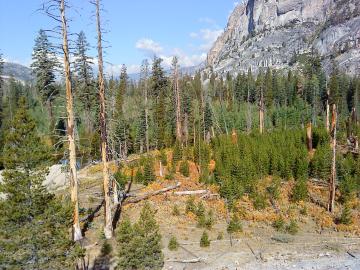
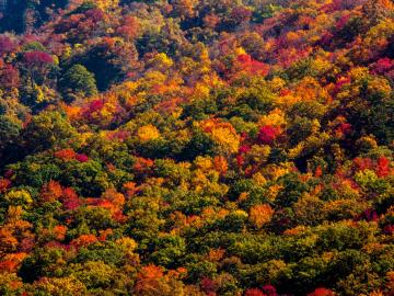
A multi-institutional research team found that changing environmental conditions are affecting forests around the globe, leading to increasing tree death and uncertainty about the ability of forests to recover.

A new computational approach by ORNL can more quickly scan large-scale satellite images, such as these of Puerto Rico, for more accurate mapping of complex infrastructure like buildings. Credit: Maxar Technologies and Dalton Lunga/Oak Ridge National Laboratory, U.S. Dept. of Energy

A novel approach developed by scientists at ORNL can scan massive datasets of large-scale satellite images to more accurately map infrastructure – such as buildings and roads – in hours versus days. 

This simulation of a fusion plasma calculation result shows the interaction of two counter-streaming beams of super-heated gas. Credit: David L. Green/Oak Ridge National Laboratory, U.S. Dept. of Energy

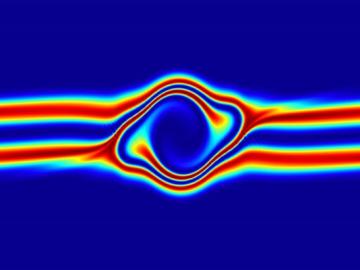
The prospect of simulating a fusion plasma is a step closer to reality thanks to a new computational tool developed by scientists in fusion physics, computer science and mathematics at ORNL.

The students analyzed diatom images like this one to compare wild and genetically modified strains of these organisms. Credit: Alison Pawlicki/Oak Ridge National Laboratory, US Department of Energy.

Students often participate in internships and receive formal training in their chosen career fields during college, but some pursue professional development opportunities even earlier.

Misha Krassovski, a computer scientist at Oak Ridge National Laboratory, stands in front of the Polarstern, a 400-foot long German icebreaker. Krassovski lived aboard the Polarstern during the first leg of the MOSAiC mission, the largest polar expedition ever. Credit: Misha Krassovski/Oak Ridge National Laboratory, U.S. Dept. of Energy

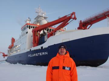
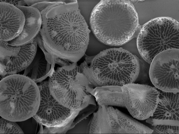
In the vast frozen whiteness of the central Arctic, the Polarstern, a German research vessel, has settled into the ice for a yearlong float.

Heat impact map

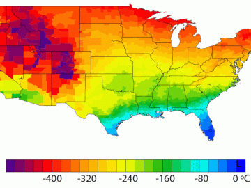
A detailed study by Oak Ridge National Laboratory estimated how much more—or less—energy United States residents might consume by 2050 relative to predicted shifts in seasonal weather patterns 

Researchers used machine learning methods on the ORNL Compute and Data Environment for Science, or CADES, to map vegetation communities in the Kougarok Watershed on the Seward Peninsula of Alaska. The colors denote different types of vegetation, such as w

A team of scientists led by Oak Ridge National Laboratory used machine learning methods to generate a high-resolution map of vegetation growing in the remote reaches of the Alaskan tundra.