
Artificial intelligence tools secure tomorrow’s electric grid
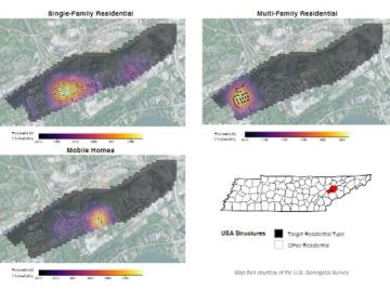
Joe Tuccillo, a human geography research scientist, leads the UrbanPop project that uses census data to create synthetic populations. Using a Python software suite called Likeness on ORNL’s high-performance computers, Tuccillo’s team generates a population with individual ‘agents’ designed to represent people that interact with other agents, facilities and services in a simulated neighborhood.
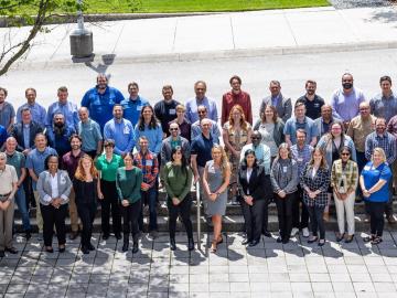
ORNL hosted the Mid-South Regional Chapter of the American Society for Photogrammetry and Remote Sensing, or ASPRS. Participants spanning government, academia and industry engaged in talks, poster sessions, events and workshops to further scientific discovery in a field devoted to using pictures to understand changes to the earth’s inhabitants and landscape.

A newly established internship between ORNL and Maryville College is bringing cybersecurity careers to a local liberal arts college. The internship was established by a Maryville College alumni who recently joined ORNL.
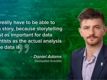
As a data scientist, Daniel Adams uses storytelling to parse through a large amount of information to determine which elements are most important, paring down the data to result in the most efficient and accurate data set possible.

Despite strong regulations and robust international safeguards, authorities routinely interdict nuclear materials outside of regulatory control. Researchers at ORNL are exploring a new method that would give authorities the ability to analyze intercepted nuclear material and determine where it originated.

Vanderbilt University and ORNL announced a partnership to develop training, testing and evaluation methods that will accelerate the Department of Defense’s adoption of AI-based systems in operational environments.
Researchers at the Department of Energy’s Oak Ridge National Laboratory met recently at an AI Summit to better understand threats surrounding artificial intelligence. The event was part of ORNL’s mission to shape the future of safe and secure AI systems charged with our nation’s most precious data.
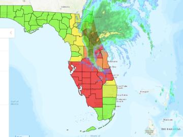
ORNL researchers have produced the most comprehensive power outage dataset ever compiled for the United States. This dataset, showing electricity outages from 2014-22 in the 50 U.S. states, Washington D.C. and Puerto Rico, details outages at 15-minute intervals for up to 92% of customers for the eight-year period.
Mohamad Zineddin hopes to establish an interdisciplinary center of excellence for nuclear security at ORNL, combining critical infrastructure assessment and protection, risk mitigation, leadership in nuclear security, education and training, nuclear security culture and resilience strategies and techniques.

Researchers at ORNL are using a machine-learning model to answer ‘what if’ questions stemming from major events that impact large numbers of people. By simulating an event, such as extreme weather, researchers can see how people might respond to adverse situations, and those outcomes can be used to improve emergency planning.
