


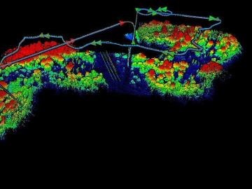
The Autonomous Systems group at ORNL is in high demand as it incorporates remote sensing into projects needing a bird’s-eye perspective.

U2opia Technology, a consortium of technology and administrative executives with extensive experience in both industry and defense, has exclusively licensed two technologies from ORNL that offer a new method for advanced cybersecurity monitoring in real time.
Having lived on three continents spanning the world’s four hemispheres, Philipe Ambrozio Dias understands the difficulties of moving to a new place.
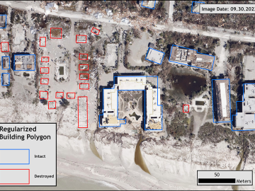
Over the past seven years, researchers in ORNL’s Geospatial Science and Human Security Division have mapped and characterized all structures within the United States and its territories to aid FEMA in its response to disasters. This dataset provides a consistent, nationwide accounting of the buildings where people reside and work.
When Matt McCarthy saw an opportunity for a young career scientist to influence public policy, he eagerly raised his hand.
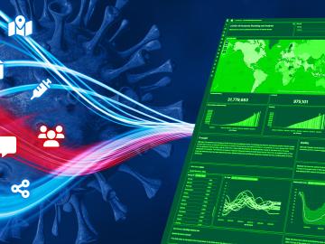
When the COVID-19 pandemic stunned the world in 2020, researchers at ORNL wondered how they could extend their support and help
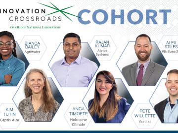
Oak Ridge National Laboratory’s Innovation Crossroads program welcomes six new science and technology innovators from across the United States to the sixth cohort.
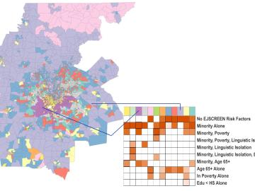
Scientists develop environmental justice lens to identify neighborhoods vulnerable to climate change
A new capability to identify urban neighborhoods, down to the block and building level, that are most vulnerable to climate change could help ensure that mitigation and resilience programs reach the people who need them the most.

It’s a simple premise: To truly improve the health, safety, and security of human beings, you must first understand where those individuals are.
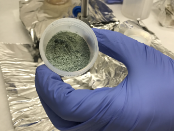
ORNL researchers used the nation’s fastest supercomputer to map the molecular vibrations of an important but little-studied uranium compound produced during the nuclear fuel cycle for results that could lead to a cleaner, safer world.