


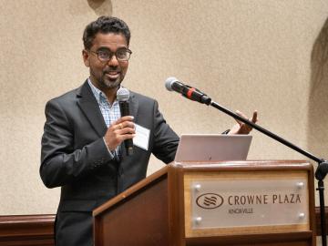
The Department of Energy’s Oak Ridge National Laboratory hosted its Smoky Mountains Computational Science and Engineering Conference for the first time in person since the COVID pandemic broke in 2020. The conference, which celebrated its 20th consecutive year, took place at the Crowne Plaza Hotel in downtown Knoxville, Tenn., in late August.
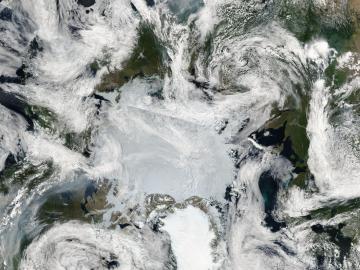
Researchers from Oak Ridge National Laboratory and Northeastern University modeled how extreme conditions in a changing climate affect the land’s ability to absorb atmospheric carbon — a key process for mitigating human-caused emissions. They found that 88% of Earth’s regions could become carbon emitters by the end of the 21st century.

Subho Mukherjee, an R&D associate in the Vehicle Power Electronics Research group at the Department of Energy’s Oak Ridge National Laboratory, has been elevated to the grade of senior member of the Institute of Electrical and Electronics Engineers.
ORNL hosted its fourth Artificial Intelligence for Robust Engineering and Science, or AIRES, workshop from April 18-20. Over 100 attendees from government, academia and industry convened to identify research challenges and investment areas, carving the future of the discipline.
Yarom Polsky, director of the Manufacturing Science Division, or MSD, at the Department of Energy’s Oak Ridge National Laboratory, has been elected a Fellow of the American Society of Mechanical Engineers, or ASME.
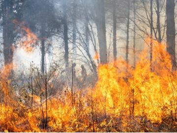
Wildfires have shaped the environment for millennia, but they are increasing in frequency, range and intensity in response to a hotter climate. The phenomenon is being incorporated into high-resolution simulations of the Earth’s climate by scientists at the Department of Energy’s Oak Ridge National Laboratory, with a mission to better understand and predict environmental change.
When geoinformatics engineering researchers at the Department of Energy’s Oak Ridge National Laboratory wanted to better understand changes in land areas and points of interest around the world, they turned to the locals — their data, at least.
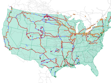
Oak Ridge National Laboratory researchers used images from a photo-sharing website to identify crude oil train routes across the nation to provide data that could help transportation planners better understand regional impacts.
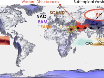
As extreme weather devastates communities worldwide, scientists are using modeling and simulation to understand how climate change impacts the frequency and intensity of these events. Although long-term climate projections and models are important, they are less helpful for short-term prediction of extreme weather that may rapidly displace thousands of people or require emergency aid.
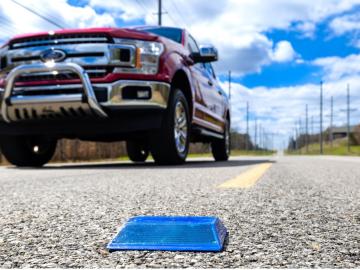
Working with Western Michigan University and other partners, ORNL engineers are placing low-powered sensors in the reflective raised pavement markers that are already used to help drivers identify lanes. Microchips inside the markers transmit information to passing cars about the road shape to help autonomous driving features function even when vehicle cameras or remote laser sensing, called LiDAR, are unreliable because of fog, snow, glare or other obstructions.