
Polyphase wireless power transfer system achieves 270-kilowatt charge, s...
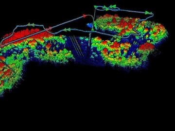
The Autonomous Systems group at ORNL is in high demand as it incorporates remote sensing into projects needing a bird’s-eye perspective.
A scientific instrument at ORNL could help create a noninvasive cancer treatment derived from a common tropical plant.
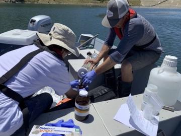
Environmental scientists at ORNL have recently expanded collaborations with minority-serving institutions and historically Black colleges and universities across the nation to broaden the experiences and skills of student scientists while bringing fresh insights to the national lab’s missions.

Warming a crystal of the mineral fresnoite, ORNL scientists discovered that excitations called phasons carried heat three times farther and faster than phonons, the excitations that usually carry heat through a material.
Natural gas furnaces not only heat your home, they also produce a lot of pollution. Even modern high-efficiency condensing furnaces produce significant amounts of corrosive acidic condensation and unhealthy levels of nitrogen oxides
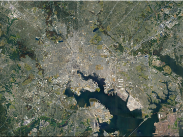
ORNL researchers are deploying their broad expertise in climate data and modeling to create science-based mitigation strategies for cities stressed by climate change as part of two U.S. Department of Energy Urban Integrated Field Laboratory projects.

In human security research, Thomaz Carvalhaes says, there are typically two perspectives: technocentric and human centric. Rather than pick just one for his work, Carvalhaes uses data from both perspectives to understand how technology impacts the lives of people.

When Matt McCarthy saw an opportunity for a young career scientist to influence public policy, he eagerly raised his hand.
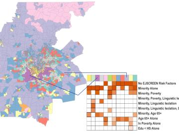
A new capability to identify urban neighborhoods, down to the block and building level, that are most vulnerable to climate change could help ensure that mitigation and resilience programs reach the people who need them the most.

It’s a simple premise: To truly improve the health, safety, and security of human beings, you must first understand where those individuals are.
