


Digital twins are exactly what they sound like: virtual models of physical reality that continuously update to reflect changes in the real world.

Scientists at ORNL used their knowledge of complex ecosystem processes, energy systems, human dynamics, computational science and Earth-scale modeling to inform the nation’s latest National Climate Assessment, which draws attention to vulnerabilities and resilience opportunities in every region of the country.
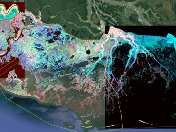
In 1993 as data managers at ORNL began compiling observations from field experiments for the National Aeronautics and Space Administration, the information fit on compact discs and was mailed to users along with printed manuals.
For 25 years, scientists at Oak Ridge National Laboratory have used their broad expertise in human health risk assessment, ecology, radiation protection, toxicology and information management to develop widely used tools and data for the U.S. Environmental Protection Agency as part of the agency’s Superfund program.
Wildfires have shaped the environment for millennia, but they are increasing in frequency, range and intensity in response to a hotter climate. The phenomenon is being incorporated into high-resolution simulations of the Earth’s climate by scientists at the Department of Energy’s Oak Ridge National Laboratory, with a mission to better understand and predict environmental change.
Scientists at ORNL have confirmed that bacteria-killing viruses called bacteriophages deploy a sneaky tactic when targeting their hosts: They use a standard genetic code when invading bacteria, then switch to an alternate code at later stages of
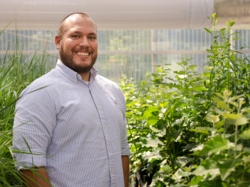
Tomás Rush began studying the mysteries of fungi in fifth grade and spent his college intern days tromping through forests, swamps and agricultural lands searching for signs of fungal plant pathogens causing disease on host plants.
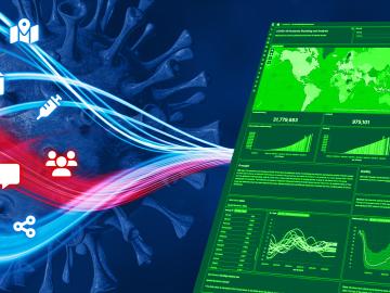
When the COVID-19 pandemic stunned the world in 2020, researchers at ORNL wondered how they could extend their support and help
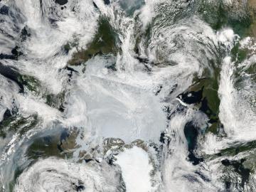
The Atmospheric Radiation Measurement Data Center is shepherding changes to its operations to make the treasure trove of data more easily available accessible and useful to scientists studying Earth’s climate.

It’s a simple premise: To truly improve the health, safety, and security of human beings, you must first understand where those individuals are.