
Polyphase wireless power transfer system achieves 270-kilowatt charge, s...

Subho Mukherjee, an R&D associate in the Vehicle Power Electronics Research group at the Department of Energy’s Oak Ridge National Laboratory, has been elevated to the grade of senior member of the Institute of Electrical and Electronics Engineers.

Researchers at the Department of Energy’s Oak Ridge National Laboratory are leading the way in understanding the effects of electrical faults in the modern U.S. power grid.
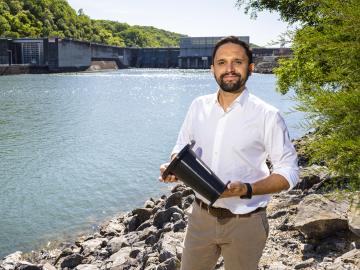
Mirko Musa spent his childhood zigzagging his bike along the Po River. The Po, Italy’s longest river, cuts through a lush valley of grain and vegetable fields, which look like a green and gold ocean spreading out from the river’s banks.
Dean Pierce of ORNL and a research team led by ORNL’s Alex Plotkowski were honored by DOE’s Vehicle Technologies Office for development of novel high-performance alloys that can withstand extreme environments.
Yarom Polsky, director of the Manufacturing Science Division, or MSD, at the Department of Energy’s Oak Ridge National Laboratory, has been elected a Fellow of the American Society of Mechanical Engineers, or ASME.
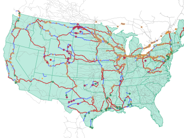
Oak Ridge National Laboratory researchers used images from a photo-sharing website to identify crude oil train routes across the nation to provide data that could help transportation planners better understand regional impacts.
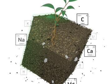
Oak Ridge National Laboratory researchers recently demonstrated use of a laser-based analytical method to accelerate understanding of critical plant and soil properties that affect bioenergy plant growth and soil carbon storage.
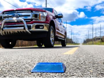
Working with Western Michigan University and other partners, ORNL engineers are placing low-powered sensors in the reflective raised pavement markers that are already used to help drivers identify lanes. Microchips inside the markers transmit information to passing cars about the road shape to help autonomous driving features function even when vehicle cameras or remote laser sensing, called LiDAR, are unreliable because of fog, snow, glare or other obstructions.
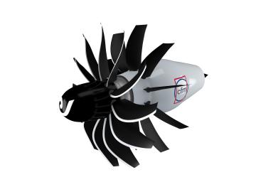
To support the development of a revolutionary new open fan engine architecture for the future of flight, GE Aerospace has run simulations using the world’s fastest supercomputer capable of crunching data in excess of exascale speed, or more than a quintillion calculations per second.
Like most scientists, Chengping Chai is not content with the surface of things: He wants to probe beyond to learn what’s really going on. But in his case, he is literally building a map of the world beneath, using seismic and acoustic data that reveal when and where the earth moves.
