ORNL will use its land surface modeling tools to determine Baltimore’s climate risk and analyze green infrastructure improvements that can help mitigate impacts on underserved communities as part of a DOE Urban Integrated Field Laboratory project. Source: Google Earth, accessed Sept. 12, 2022

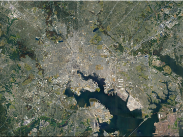
ORNL researchers are deploying their broad expertise in climate data and modeling to create science-based mitigation strategies for cities stressed by climate change as part of two U.S. Department of Energy Urban Integrated Field Laboratory projects.

The ORNL researchers’ findings may enable better detection of uranium tetrafluoride hydrate, a little-studied byproduct of the nuclear fuel cycle, and better understanding of how environmental conditions influence the chemical behavior of fuel cycle materials. Credit: Kevin Pastoor/Colorado School of Mines

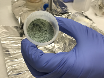
ORNL researchers used the nation’s fastest supercomputer to map the molecular vibrations of an important but little-studied uranium compound produced during the nuclear fuel cycle for results that could lead to a cleaner, safer world.

The Energy Exascale Earth System Model project reliably simulates aspects of earth system variability and projects decadal changes that will critically impact the U.S. energy sector in the future. A new version of the model delivers twice the performance of its predecessor. Credit: E3SM, Dept. of Energy

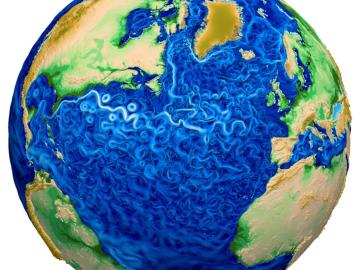
A new version of the Energy Exascale Earth System Model, or E3SM, is two times faster than an earlier version released in 2018.