
Polyphase wireless power transfer system achieves 270-kilowatt charge, s...

A new tool from Oak Ridge National Laboratory can help planners, emergency responders and scientists visualize how flood waters will spread for any scenario and terrain.
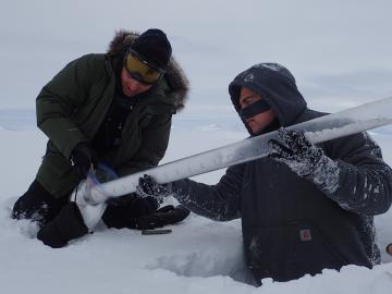
For the past six years, some 140 scientists from five institutions have traveled to the Arctic Circle and beyond to gather field data as part of the Department of Energy-sponsored NGEE Arctic project. This article gives insight into how scientists gather the measurements that inform t...
