


Oak Ridge National Laboratory was among an international team, led by Lawrence Livermore National Laboratory, who synthesized 108 elevated carbon dioxide, or CO2, experiments performed in various ecosystems to find out how much carbon is

Researchers at Oak Ridge National Laboratory have identified a statistical relationship between the growth of cities and the spread of paved surfaces like roads and sidewalks. These impervious surfaces impede the flow of water into the ground, affecting the water cycle and, by extension, the climate.

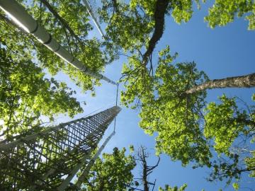
Cory Stuart of ORNL applies his expertise as a systems engineer to ensure the secure and timely transfer of millions of measurements of Earth’s atmosphere, fueling science around the world.
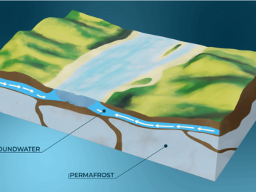
A study by Oak Ridge National Laboratory, the University of Copenhagen, the National Park Service and the U.S. Geological Survey showed that hotter summers and permafrost loss are causing colder water to flow into Arctic streams, which could impact sensitive fish and other wildlife.
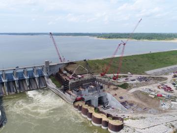
A new Department of Energy report produced by Oak Ridge National Laboratory details national and international trends in hydropower, including the role waterpower plays in enhancing the flexibility and resilience of the power grid.

A new tool from Oak Ridge National Laboratory can help planners, emergency responders and scientists visualize how flood waters will spread for any scenario and terrain.