
Katy Bradford: Cassette approach offers compelling construction solution

Daryl Yang is coupling his science and engineering expertise to devise new ways to measure significant changes going on in the Arctic, a region that’s warming nearly four times faster than other parts of the planet. The remote sensing technologies and modeling tools he develops and leverages for the Next-Generation Ecosystem Experiments in the Arctic project, or NGEE Arctic, help improve models of the ecosystem to better inform decision-making as the landscape changes.
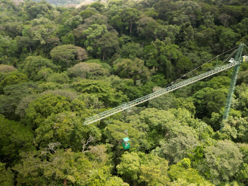
Scientists using high-resolution aerial scans and computational modeling concluded that wildfires, storms and selective logging have become key drivers behind rainforest carbon emissions, outpacing clear-cutting practices.
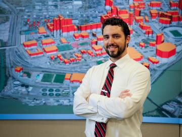
ORNL’s Joshua New was named the 2024 Researcher of the Year by R&D World magazine as part of its R&D 100 Professional Award winners.
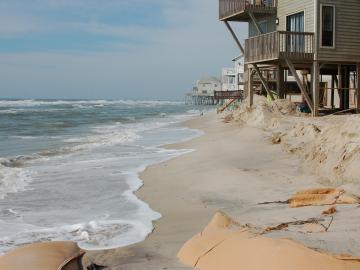
A study found that beaches with manmade fortifications recover more slowly from hurricanes than natural beaches, losing more sand and vegetation. The researchers used satellite images and light detection and ranging data, or LIDAR, to measure elevation changes and vegetation coverage. Changes in elevation showed how much sand was depleted during the storm and how much sand returned throughout the following year.
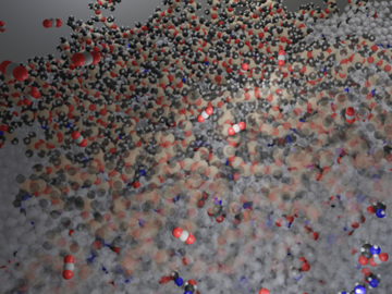
Researchers at ORNL have demonstrated that small molecular tweaks to surfaces can improve absorption technology for direct air capture of carbon dioxide. The team added a charged polymer layer to an amino acid solution, and then, through spectroscopy and simulation, found that the charged layer can hold amino acids at its surface.

To better predict long-term flooding risk, scientists at the Department of Energy’s Oak Ridge National Laboratory developed a 3D modeling framework that captures the complex dynamics of water as it flows across the landscape. The framework seeks to provide valuable insights into which communities are most vulnerable as the climate changes, and was developed for a project that’s assessing climate risk and mitigation pathways for an urban area along the Southeast Texas coast.
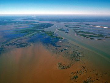
In the wet, muddy places where America’s rivers and lands meet the sea, scientists from the Department of Energy’s Oak Ridge National Laboratory are unearthing clues to better understand how these vital landscapes are evolving under climate change.

Oak Ridge National Laboratory scientists have developed a method leveraging artificial intelligence to accelerate the identification of environmentally friendly solvents for industrial carbon capture, biomass processing, rechargeable batteries and other applications.

Researchers at Oak Ridge National Laboratory have developed free data sets to estimate how much energy any building in the contiguous U.S. will use in 2100. These data sets provide planners a way to anticipate future energy needs as the climate changes.

Researchers at ORNL and the University of Maine have designed and 3D-printed a single-piece, recyclable natural-material floor panel tested to be strong enough to replace construction materials like steel.
