


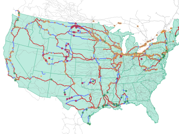
Oak Ridge National Laboratory researchers used images from a photo-sharing website to identify crude oil train routes across the nation to provide data that could help transportation planners better understand regional impacts.
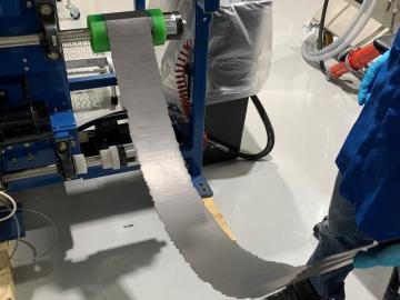
Early experiments at the Department of Energy’s Oak Ridge National Laboratory have revealed significant benefits to a dry battery manufacturing process. This eliminates the use of solvents and is more affordable, while showing promise for delivering a battery that is durable, less weighed down by inactive elements, and able to maintain a high capacity after use.
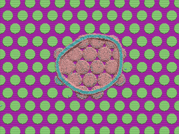
Over the past decade, teams of engineers, chemists and biologists have analyzed the physical and chemical properties of cicada wings, hoping to unlock the secret of their ability to kill microbes on contact. If this function of nature can be replicated by science, it may lead to products with inherently antibacterial surfaces that are more effective than current chemical treatments.
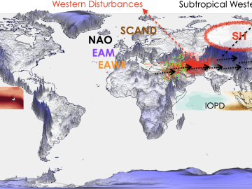
As extreme weather devastates communities worldwide, scientists are using modeling and simulation to understand how climate change impacts the frequency and intensity of these events. Although long-term climate projections and models are important, they are less helpful for short-term prediction of extreme weather that may rapidly displace thousands of people or require emergency aid.
Growing up exploring the parklands of India where Rudyard Kipling drew inspiration for The Jungle Book left Saubhagya Rathore with a deep respect and curiosity about the natural world. He later turned that interest into a career in environmental science and engineering, and today he is working at ORNL to improve our understanding of watersheds for better climate prediction and resilience.
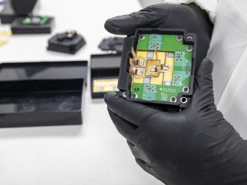
Researchers at the Department of Energy’s Oak Ridge National Laboratory are supporting the grid by improving its smallest building blocks: power modules that act as digital switches.
Tristen Mullins enjoys the hidden side of computers. As a signals processing engineer for ORNL, she tries to uncover information hidden in components used on the nation’s power grid — information that may be susceptible to cyberattacks.
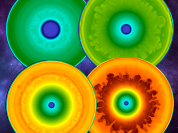
As a result of largescale 3D supernova simulations conducted on the Oak Ridge Leadership Computing Facility’s Summit supercomputer by researchers from the University of Tennessee and Oak Ridge National Laboratory, astrophysicists now have the most complete picture yet of what gravitational waves from exploding stars look like.
Scientist-inventors from ORNL will present seven new technologies during the Technology Innovation Showcase on Friday, July 14, from 8 a.m.–4 p.m. at the Joint Institute for Computational Sciences on ORNL’s campus.
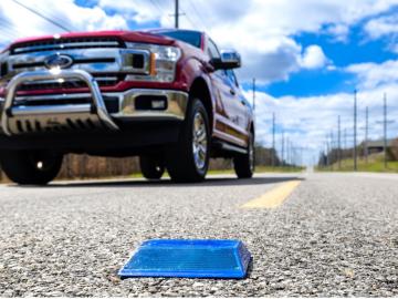
Working with Western Michigan University and other partners, ORNL engineers are placing low-powered sensors in the reflective raised pavement markers that are already used to help drivers identify lanes. Microchips inside the markers transmit information to passing cars about the road shape to help autonomous driving features function even when vehicle cameras or remote laser sensing, called LiDAR, are unreliable because of fog, snow, glare or other obstructions.