
Katy Bradford: Cassette approach offers compelling construction solution
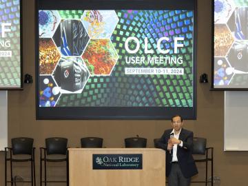
The Oak Ridge Leadership Computing Facility welcomed users to an interactive meeting at the Department of Energy’s Oak Ridge National Laboratory from Sept. 10–11 for an opportunity to share achievements from the OLCF’s user programs and highlight requirements for the future.
A new technical collaboration program at the Department of Energy’s Oak Ridge National Laboratory will help businesses develop and launch electric grid innovations. Sponsored by the Transformer Resilience and Advanced Components program in DOE’s Office of Electricity, the initiative will provide companies with access to national laboratory resources, enabling them to capture market opportunities.

Daryl Yang is coupling his science and engineering expertise to devise new ways to measure significant changes going on in the Arctic, a region that’s warming nearly four times faster than other parts of the planet. The remote sensing technologies and modeling tools he develops and leverages for the Next-Generation Ecosystem Experiments in the Arctic project, or NGEE Arctic, help improve models of the ecosystem to better inform decision-making as the landscape changes.
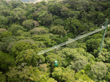
Scientists using high-resolution aerial scans and computational modeling concluded that wildfires, storms and selective logging have become key drivers behind rainforest carbon emissions, outpacing clear-cutting practices.

A team led by scientists at ORNL identified and demonstrated a method to process a plant-based material called nanocellulose that reduced energy needs by a whopping 21%, using simulations on the lab’s supercomputers and follow-on analysis.
As a mechanical engineer in building envelope materials research at ORNL, Bryan Maldonado sees opportunities to apply his scientific expertise virtually everywhere he goes, from coast to coast. As an expert in understanding how complex systems operate, he’s using machine learning methods to control the process and ultimately optimize performance.

Nuclear physicists at the Department of Energy’s Oak Ridge National Laboratory recently used Frontier, the world’s most powerful supercomputer, to calculate the magnetic properties of calcium-48’s atomic nucleus.

A digital construction platform in development at Oak Ridge National Laboratory is boosting the retrofitting of building envelopes and giving builders the tools to automate the process from design to installation with the assistance of a cable-driven robotic crane.

Researchers at ORNL recently demonstrated an automated drone-inspection technology at EPB of Chattanooga that will allow utilities to more quickly and easily check remote power lines for malfunctions, catching problems before outages occur.
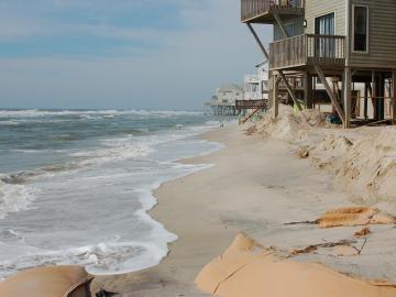
A study found that beaches with manmade fortifications recover more slowly from hurricanes than natural beaches, losing more sand and vegetation. The researchers used satellite images and light detection and ranging data, or LIDAR, to measure elevation changes and vegetation coverage. Changes in elevation showed how much sand was depleted during the storm and how much sand returned throughout the following year.
