ORNL will use its land surface modeling tools to determine Baltimore’s climate risk and analyze green infrastructure improvements that can help mitigate impacts on underserved communities as part of a DOE Urban Integrated Field Laboratory project. Source: Google Earth, accessed Sept. 12, 2022

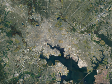
ORNL researchers are deploying their broad expertise in climate data and modeling to create science-based mitigation strategies for cities stressed by climate change as part of two U.S. Department of Energy Urban Integrated Field Laboratory projects.

Matt McCarthy uses images collected from the sky to interpret changes to the coastlines and oceans for national security research. Credit: Carlos Jones and Rachel Green/ORNL, U.S. Dept. of Energy

When Matt McCarthy saw an opportunity for a young career scientist to influence public policy, he eagerly raised his hand.

Data from different sources are joined on platforms created by ORNL researchers to offer better information for decision makers. Credit: ORNL/Nathan Armistead

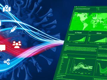
When the COVID-19 pandemic stunned the world in 2020, researchers at ORNL wondered how they could extend their support and help

ORNL identity science researcher Nell Barber works on a facial recognition camera. Credit: Genevieve Martin/ORNL, U.S. Dept. of Energy

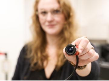
Though Nell Barber wasn’t sure what her future held after graduating with a bachelor’s degree in psychology, she now uses her interest in human behavior to design systems that leverage machine learning algorithms to identify faces in a crowd.
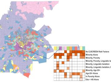
ORNL scientists created a geodemographic cluster for the Atlanta metro area that identifies risk factors related to climate impacts. Credit: ORNL/U.S. Dept. of Energy

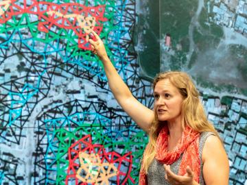
A new capability to identify urban neighborhoods, down to the block and building level, that are most vulnerable to climate change could help ensure that mitigation and resilience programs reach the people who need them the most.

Logan Sturm, Alvin M. Weinberg Fellow at ORNL, creates a mashup between additive manufacturing and cybersecurity research. Credit: Carlos Jones/ORNL, U.S. Dept. of Energy

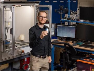
How an Alvin M. Weinberg Fellow is increasing security for critical infrastructure components

LandScan Global depicts population distribution estimates across the planet. The darker orange and red colors above indicate higher population density. Credit: ORNL, U.S. Dept. of Energy

It’s a simple premise: To truly improve the health, safety, and security of human beings, you must first understand where those individuals are.

Earth Day

Tackling the climate crisis and achieving an equitable clean energy future are among the biggest challenges of our time. 

ORNL research scientist Christa Brelsford explained a mathematical framework she developed in 2018, which showed increased availability of infrastructure didn’t necessarily reduce inequality in its access. Credit: Carlos Jones/ORNL, U.S. Dept. of Energy

Unequal access to modern infrastructure is a feature of growing cities, according to a study published this week in the Proceedings of the National Academy of Sciences

QLAN submit - A team from the U.S. Department of Energy’s Oak Ridge National Laboratory, Stanford University and Purdue University developed and demonstrated a novel, fully functional quantum local area network, or QLAN, to enable real-time adjustments to information shared with geographically isolated systems at ORNL using entangled photons passing through optical fiber. Credit: Carlos Jones/ORNL, U.S. Dept. of Energy

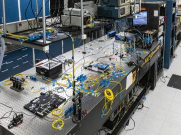
A rapidly emerging consensus in the scientific community predicts the future will be defined by humanity’s ability to exploit the laws of quantum mechanics.