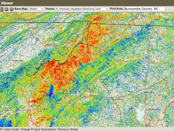
The ForWarn visualization tool was co-developed by ORNL with the U.S. Forest Service. The tool captures and analyzes satellite imagery to track impacts such as storms, wildfire and pests on forests across the nation.
The ForWarn visualization tool was co-developed by ORNL with the U.S. Forest Service. The tool captures and analyzes satellite imagery to track impacts such as storms, wildfire and pests on forests across the nation.