Jesse Labbé: Innovating biotechnology for energy, security and health
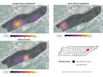
Joe Tuccillo, a human geography research scientist, leads the UrbanPop project that uses census data to create synthetic populations. Using a Python software suite called Likeness on ORNL’s high-performance computers, Tuccillo’s team generates a population with individual ‘agents’ designed to represent people that interact with other agents, facilities and services in a simulated neighborhood.
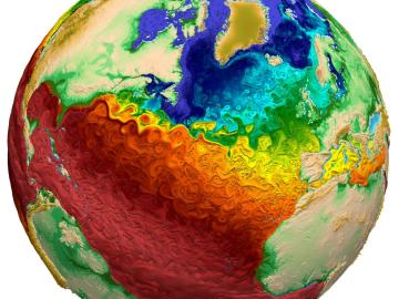
A team from DOE’s Oak Ridge, Los Alamos and Sandia National Laboratories has developed a new solver algorithm that reduces the total run time of the Model for Prediction Across Scales-Ocean, or MPAS-Ocean, E3SM’s ocean circulation model, by 45%.
Walters is working with a team of geographers, linguists, economists, data scientists and software engineers to apply cultural knowledge and patterns to open-source data in an effort to document and report patterns of human movement through previously unstudied spaces.
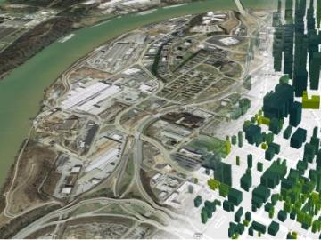
Two years after ORNL provided a model of nearly every building in America, commercial partners are using the tool for tasks ranging from designing energy-efficient buildings and cities to linking energy efficiency to real estate value and risk.