
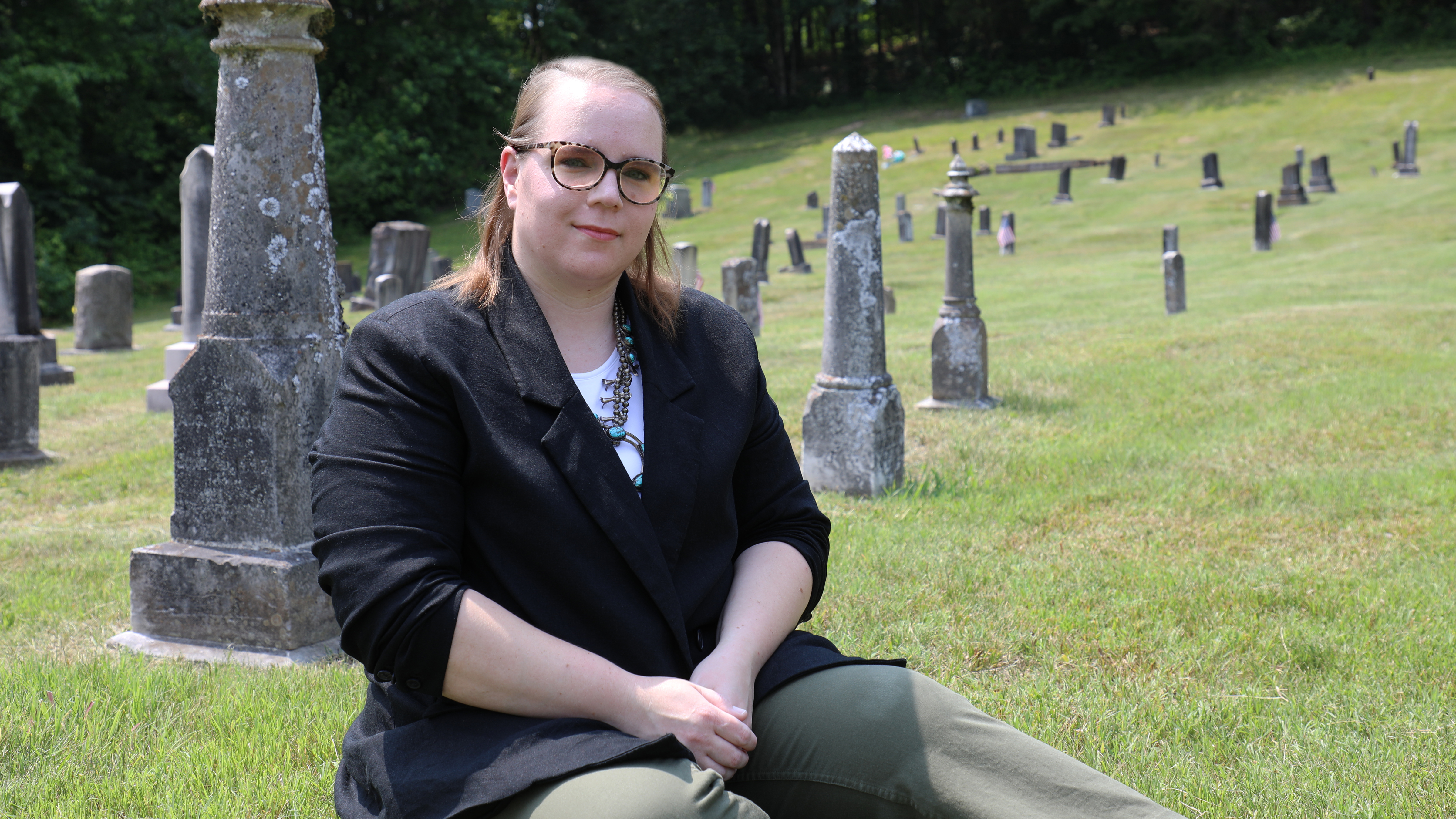
ORNL’s Sarah Walters leverages her anthropology expertise to study cultural information, such as funeral rites, as part of the lab’s Population Density Tables, or PDT, project. Credit: Lena Shoemaker/ORNL, U.S. Dept. of Energy
What do ship ports and cemeteries have in common? According to Sarah Walters, an anthropologist at the Department of Energy’s Oak Ridge National Laboratory, they are both multi-use spaces that inform human population and activity patterns.
Walters is working with a team of geographers, linguists, economists, data scientists and software engineers to apply cultural knowledge and patterns to open-source data in an effort to document and report patterns of human movement through previously unstudied spaces.
As part of the Population Density Tables, or PDT, project, Walters and her team capture human activity patterns by understanding how people occupy spaces and how human movement impacts these spaces. The team uses a broad spectrum of open-source data along with a machine-learning model that can automatically analyze satellite images to identify and count a particular feature that then informs facility occupancy and use. For many buildings, the number of people coming and going in a particular day is not recorded, nor is what those people are doing in that place.
For instance, consider football stadiums. These buildings were created for and serve a specific purpose, and with that purpose comes a need to document and understand activity patterns of attendees, such as to monitor safety and security during events. Conversely, while post offices as buildings may have a clear purpose, the number of people who go through post offices daily is not closely monitored.
“No one is standing outside of the post office keeping track of how many people come in and out,” Walters said.
As with post offices, quantitative data regarding how people use ports or cemeteries is historically lacking, and both of these spaces hold a lot of potential for studying patterns of human movement and population changes over time.
In particular, Walters is interested in the multi-use nature of these spaces. Through a counting-based computer software and machine-learning algorithm currently in development by colleagues in ORNL’s GeoAI group, Walters can use a trained model to identify and enumerate objects from high-resolution satellite imagery. In the long term, this algorithm could be trained to work in tandem with a model or a researcher to identify changes in patterns of human activity and movement over time.
Walters and the PDT team conduct research and develop observations to inform the occupancy estimates using open-source data that is gathered from a broad range of outlets, such as country-level census data, surveys from NGOs and similar organizations, academic journals and local news articles.
These estimates then serve to inform a wide variety of functions ranging from high-resolution population distribution modeling — such as LandScan, ORNL’s suite of gridded population datasets — to building energy research, disaster preparedness and response, as well as other essential humanitarian aid efforts.
While ship movement and cargo data does exist for ports, similar data currently does not exist for the people who move in and out of them. Ports hold more activity than just the movement of shipped goods. While ports were previously tracked as singular entities that accounted primarily for the movement of goods, Walters and the PDT team are delving into the human aspect of ports, accounting for the movement of the people who work in the ports, the people who work on the vessels themselves and the people who travel through, such as cruise ship passengers.
Like ports, cemeteries are typically viewed through a single lens, but Walters says these resting places provide more for the living than they do for the dead. Beyond funerals and grave visitation, cemeteries have a variety of uses. Many people use them as safe places to run or meditate. Others use the sparsely trafficked roads as a space to learn to drive. Or, for some displaced populations, cemeteries may serve as places of refuge.
The previously long, arduous process of hand-counting grave markers on printed satellite images can be completed in a fraction of the time through an object-detection algorithm. The team feeds the algorithm open source images of headstones and other markers, training it to automatically and instantly recognize and document marked burial sites. This allows researchers like Walters to quickly and accurately document changes within cemeteries. For instance, in conjunction with notable cultural, historical or environmental changes, a sharp increase in human presence or activity in cemeteries accompanied by an increase in new grave sites may indicate a conflict or disaster in the area.
But the algorithm can only determine so much on its own. Burial practices vary across countries, cultures and religions, creating a large variety of different grave sites that the algorithm has to identify. This is where Walters’ anthropology expertise comes in. Studying cultural information, such as funeral rites, allows her to anticipate the number of people who may visit a cemetery in a particular area. This gives her the ability to inform the PDT models and create a more specific and accurate picture of the patterns of human presence in spaces where one would not normally consider the variability of human activity.
Beyond learning and documenting varying uses and cultural importance within given spaces, the PDT team’s work can aid in humanitarian efforts, such as providing disaster relief teams with the average number of people who may be in an area at a given time. In addition, having a clear view of the movement of populations through spaces, human activity and presence statistics can also provide more information for researchers to consider in addressing issues of national security, disease control and prevention and disaster mitigation.
These automation efforts from GeoAI support the PDT project, which was established to capture the local sociocultural and economic use of buildings or facility complexes through building occupancy and population density observations for more than 60 facility types around the globe, including cemeteries and ports.
Walters’ research into the day-to-day activities of people within multi-use spaces keeps her alert and engaged. In an ever-evolving world, there is always something new for her to look into.
“There’s never a dull day at work,” she said, “because there’s always something new to learn.”
UT-Battelle manages ORNL for the Department of Energy’s Office of Science, the single largest supporter of basic research in the physical sciences in the United States. The Office of Science is working to address some of the most pressing challenges of our time. For more information, please visit energy.gov/science. — Lena Shoemaker
