
Robert Hettich: Decoding biological complexity with next-gen mass spectrometry
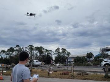
During Hurricanes Helene and Milton, ORNL deployed drone teams and the Mapster platform to gather and share geospatial data, aiding recovery and damage assessments. ORNL's EAGLE-I platform tracked utility outages, helping prioritize recovery efforts. Drone data will train machine learning models for faster damage detection in future disasters.

The Department of Energy’s Oak Ridge National Laboratory announced the establishment of the Center for AI Security Research, or CAISER, to address threats already present as governments and industries around the world adopt artificial intelligence and take advantage of the benefits it promises in data processing, operational efficiencies and decision-making.
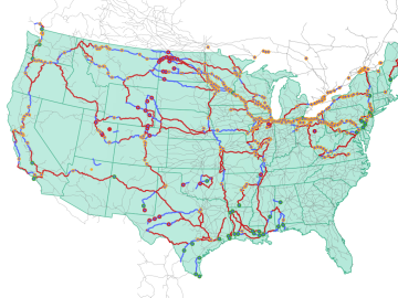
Oak Ridge National Laboratory researchers used images from a photo-sharing website to identify crude oil train routes across the nation to provide data that could help transportation planners better understand regional impacts.
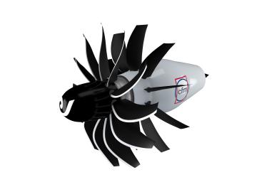
To support the development of a revolutionary new open fan engine architecture for the future of flight, GE Aerospace has run simulations using the world’s fastest supercomputer capable of crunching data in excess of exascale speed, or more than a quintillion calculations per second.

When the COVID-19 pandemic stunned the world in 2020, researchers at ORNL wondered how they could extend their support and help

It’s a simple premise: To truly improve the health, safety, and security of human beings, you must first understand where those individuals are.
It’s been referenced in Popular Science and Newsweek, cited in the Economic Report of the President, and used by agencies to create countless federal regulations.

Ross Wang has been intent on resolving traffic jams since he rode a city bus every day through 40 minutes of traffic to get to his elementary school. That daily journey left an impression that would shape his career.
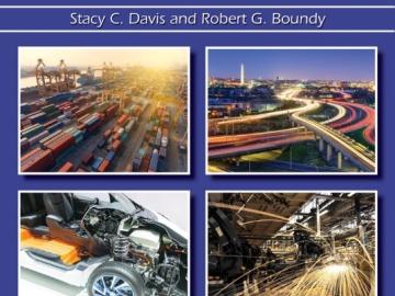
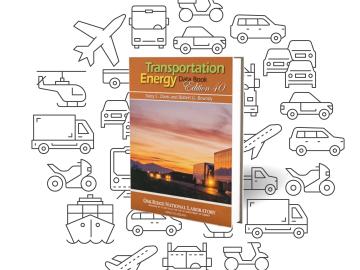
Oak Ridge National Laboratory’s latest Transportation Energy Data Book: Edition 37 reports that the number of vehicles nationwide is growing faster than the population, with sales more than 17 million since 2015, and the average household vehicle travels more than 11,000 miles per year.