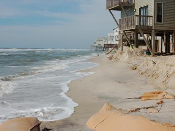
A study found that beaches with manmade fortifications recover more slowly from hurricanes than natural beaches, losing more sand and vegetation.
A study found that beaches with manmade fortifications recover more slowly from hurricanes than natural beaches, losing more sand and vegetation.
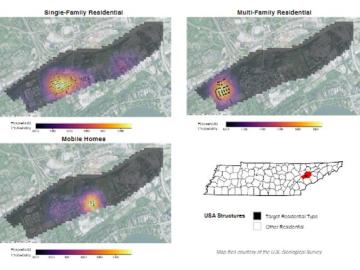
Joe Tuccillo, a human geography research scientist, leads the UrbanPop project that uses census data to create synthetic populations.
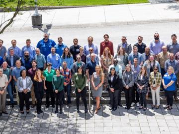
ORNL hosted the Mid-South Regional Chapter of the American Society for Photogrammetry and Remote Sensing, or ASPRS.
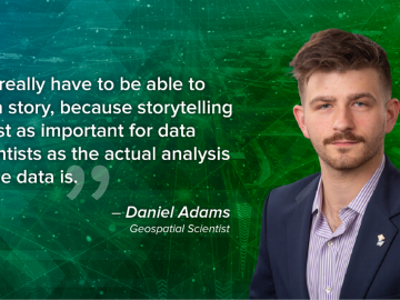
As a data scientist, Daniel Adams uses storytelling to parse through a large amount of information to determine which elements are most important, paring down the data to result in the most efficient and accurate data set possible.

ORNL drone and geospatial team becomes first to map the Coca River in the Amazon basin as erosion and sediment threaten Ecuador’s lands.
Researchers at ORNL are using a machine-learning model to answer ‘what if’ questions stemming from major events that impact large numbers of people.
ORNL’s Assaf Anyamba has spent his career using satellite images to determine where extreme weather may lead to vector-borne disease outbreaks. His work has helped the U.S.

ORNL took home the top honors in three categories at the second annual DOE Geospatial Science Poster competition, held on National GIS Day. For the second year in a row, DOE awarded ORNL top prize as Best Geospatial Program.

ORNL scientists and researchers attended the annual American Geophysical Union meeting and came away inspired for the year ahead in geospatial, earth and climate science.
Jack Orebaugh, a forensic anthropology major at the University of Tennessee, Knoxville, has a big heart for families with missing loved ones.