1 - 10 of 11 Results
Dual-GP addresses limitations in traditional GPBO-driven autonomous experimentation by incorporating an additional surrogate observer and allowing human oversight, this technique improves optimization efficiency via data quality assessment and adaptability to unanticipated exp

The invention introduces a novel, customizable method to create, manipulate, and erase polar topological structures in ferroelectric materials using atomic force microscopy.

Scanning transmission electron microscopes are useful for a variety of applications. Atomic defects in materials are critical for areas such as quantum photonics, magnetic storage, and catalysis.

Water heaters and heating, ventilation, and air conditioning (HVAC) systems collectively consume about 58% of home energy use.

A human-in-the-loop machine learning (hML) technology potentially enhances experimental workflows by integrating human expertise with AI automation.
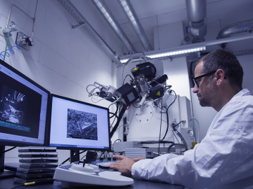
The scanning transmission electron microscope (STEM) provides unprecedented spatial resolution and is critical for many applications, primarily for imaging matter at the atomic and nanoscales and obtaining spectroscopic information at similar length scales.
We have developed an aerosol sampling technique to enable collection of trace materials such as actinides in the atmosphere.
MAPSTER is a lightweight software package that automatically searches deployed laptops for geospatial data and complies metadata (GPS coordinates, file size, etc) at a central checkpoint.

In scientific research and industrial applications, selecting the most accurate model to describe a relationship between input parameters and target characteristics of experiments is crucial.

This invention presents technologies for characterizing physical properties of a sample's surface by combining image processing with machine learning techniques.