
Quantum precision reached in modeling molten salt behavior
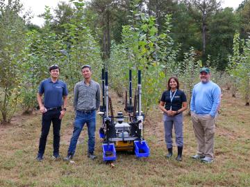
Scientists at the Department of Energy’s Oak Ridge National Laboratory recently demonstrated an autonomous robotic field monitoring, sampling and data-gathering system that could accelerate understanding of interactions among plants, soil and the environment.

A new Global Biomass Resource Assessment developed by ORNL scientists gathered data from 55 countries resulting in a first-of-its kind compilation of current and future sustainable biomass supply estimates around the world.
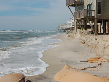
A study found that beaches with manmade fortifications recover more slowly from hurricanes than natural beaches, losing more sand and vegetation. The researchers used satellite images and light detection and ranging data, or LIDAR, to measure elevation changes and vegetation coverage. Changes in elevation showed how much sand was depleted during the storm and how much sand returned throughout the following year.

John Lagergren, a staff scientist in Oak Ridge National Laboratory’s Plant Systems Biology group, is using his expertise in applied math and machine learning to develop neural networks to quickly analyze the vast amounts of data on plant traits amassed at ORNL’s Advanced Plant Phenotyping Laboratory.
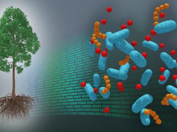
A first-ever dataset bridging molecular information about the poplar tree microbiome to ecosystem-level processes has been released by a team of DOE scientists led by ORNL. The project aims to inform research regarding how natural systems function, their vulnerability to a changing climate and ultimately how plants might be engineered for better performance as sources of bioenergy and natural carbon storage.
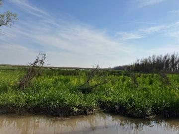
Scientists at the Department of Energy’s Oak Ridge National Laboratory are using a new modeling framework in conjunction with data collected from marshes in the Mississippi Delta to improve predictions of climate-warming methane and nitrous oxide.
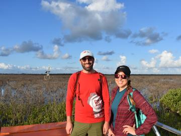
To better understand important dynamics at play in flood-prone coastal areas, Oak Ridge National Laboratory scientists working on simulations of Earth’s carbon and nutrient cycles paid a visit to experimentalists gathering data in a Texas wetland.

In 1993 as data managers at ORNL began compiling observations from field experiments for the National Aeronautics and Space Administration, the information fit on compact discs and was mailed to users along with printed manuals.
For 25 years, scientists at Oak Ridge National Laboratory have used their broad expertise in human health risk assessment, ecology, radiation protection, toxicology and information management to develop widely used tools and data for the U.S. Environmental Protection Agency as part of the agency’s Superfund program.

From the Arctic to the Amazon, understanding the atmosphere is key to understanding our climate and other Earth systems. The ARM Data Center collects and manages global observational and experimental data amassed by the Department of Energy Office of Science’s Atmospheric Radiation Measurement user facility. For the past 30 years, it has been making this data accessible to scientists around the world who study and model the Earth’s climate.
