ORNL's Communications team works with news media seeking information about the laboratory. Media may use the resources listed below or send questions to news@ornl.gov.
1 - 10 of 141 Results
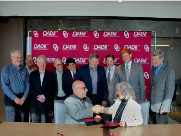
The University of Oklahoma and Oak Ridge National Laboratory, the Department of Energy’s largest multi-program science and energy laboratory, have entered a strategic collaboration to establish a cutting-edge additive manufacturing center based in Norman, OK.

In collaboration with the U.S. Department of Homeland Security’s Science and Technology Directorate, researchers at ORNL are evaluating technology to detect compounds emitted by pathogens and pests in agricultural products at the nation’s border.
Training nuclear safety experts to measure the unseen: ORNL’s course enhances nuclear accountability
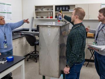
Professionals from government and industry gathered at ORNL for the Nondestructive Assay Holdup Measurements Training Course for Nuclear Criticality Safety, a hands-on training in nondestructive assay, a technique for detecting and quantifying holdup without disturbing operations.

During his first visit to Oak Ridge National Laboratory, Energy Secretary Chris Wright compared the urgency of the Lab’s World War II beginnings to today’s global race to lead in artificial intelligence, calling for a “Manhattan Project 2.”

Researchers at the Department of Energy’s Oak Ridge National Laboratory are using non-weather data from the nationwide weather radar network to understand how to track non-meteorological events moving through the air for better emergency response.
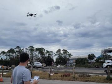
During Hurricanes Helene and Milton, ORNL deployed drone teams and the Mapster platform to gather and share geospatial data, aiding recovery and damage assessments. ORNL's EAGLE-I platform tracked utility outages, helping prioritize recovery efforts. Drone data will train machine learning models for faster damage detection in future disasters.

A team of researchers at ORNL are using virtual reality to understand normal and abnormal human behavior in a given location – specifically, a nuclear reactor. As people move around their lives, they tend to do similar activities in the same
The US focuses on nuclear nonproliferation, and ORNL plays a key role in this mission. The lab conducts advanced research in uranium science, materials analysis and nuclear forensics to detect illicit nuclear activities. Using cutting-edge tools and operational systems, ORNL supports global efforts to reduce nuclear threats by uncovering the history of nuclear materials and providing solutions for uranium removal.

The National Center for Computational Sciences, located at the Department of Energy’s Oak Ridge National Laboratory, made a strong showing at computing conferences this fall. Staff from across the center participated in numerous workshops and invited speaking engagements.
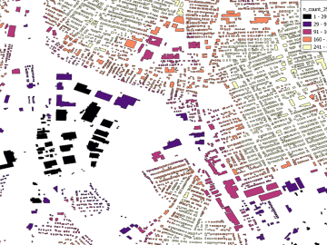
Researchers are using machine learning to provide a more complete picture of building geometries that include building height to within three meters of accuracy. This model not only provides building height for any building in the world, but it will also feed into LandScan and other large government datasets for planning and response.