ORNL's Communications team works with news media seeking information about the laboratory. Media may use the resources listed below or send questions to news@ornl.gov.
1 - 10 of 63 Results
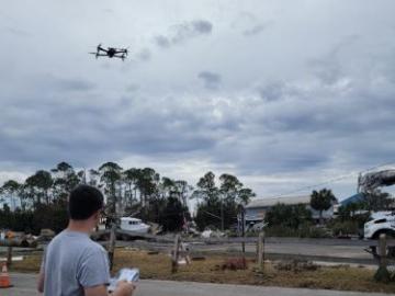
During Hurricanes Helene and Milton, ORNL deployed drone teams and the Mapster platform to gather and share geospatial data, aiding recovery and damage assessments. ORNL's EAGLE-I platform tracked utility outages, helping prioritize recovery efforts. Drone data will train machine learning models for faster damage detection in future disasters.
Researchers at ORNL are using microwave radar reflection to nondestructively detect and measure the moisture content of materials within walls without removing drywall or cladding. This also expedites the moisture identification process and enables mold growth to be treated in the early stages.

ORNL, as a partner in the DOE’s Stor4Build Consortium, is co-leading research with several national laboratories to develop thermal energy storage to complement electrical battery storage and recently hosted a two-day workshop focused on advancing these technologies.

A team of researchers at ORNL are using virtual reality to understand normal and abnormal human behavior in a given location – specifically, a nuclear reactor. As people move around their lives, they tend to do similar activities in the same
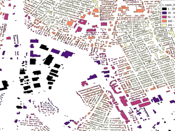
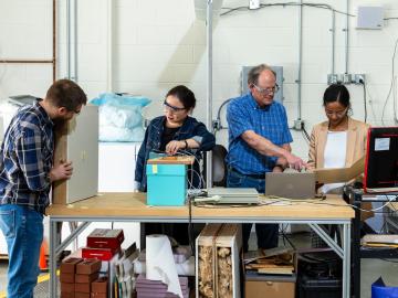
Researchers are using machine learning to provide a more complete picture of building geometries that include building height to within three meters of accuracy. This model not only provides building height for any building in the world, but it will also feed into LandScan and other large government datasets for planning and response.

Scientists at ORNL have developed a first-ever urban heat wave simulation that takes into account the compounding effects from building infrastructure. The method provides a more accurate picture of the impacts from excessive heat on at-risk
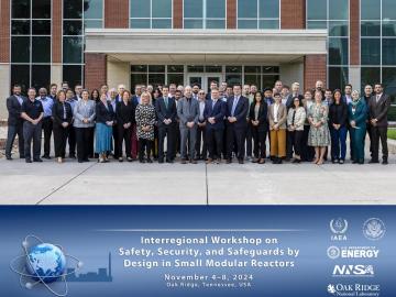
In early November, ORNL hosted the International Atomic Energy Agency (IAEA) Interregional Workshop on Safety, Security and Safeguards by Design in Small Modular Reactors, which welcomed 76 attendees representing 15 countries, three U.S. national labs, domestic and international industry partners, as well as IAEA officers.

Joel Brogan, who leads the Multimodal Sensor Analytics group at Oak Ridge National Laboratory, has been elevated to senior membership in the Institute of Electrical and Electronics Engineers.

Hempitecture, a graduate of the Innovation Crossroads program, has been awarded $8.4 million by the DOE's Office of Manufacturing and Energy Supply Chains. As part of the grant, Hempitecture will establish a facility in East Tennessee.

The Department of Energy’s Office of Electricity, in partnership with ORNL, has launched an experimental platform for energy sector-related data with enhanced emphasis on governance and usability.