ORNL's Communications team works with news media seeking information about the laboratory. Media may use the resources listed below or send questions to news@ornl.gov.
1 - 10 of 69 Results
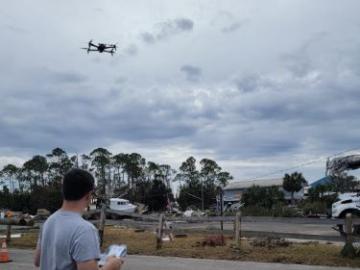
During Hurricanes Helene and Milton, ORNL deployed drone teams and the Mapster platform to gather and share geospatial data, aiding recovery and damage assessments. ORNL's EAGLE-I platform tracked utility outages, helping prioritize recovery efforts. Drone data will train machine learning models for faster damage detection in future disasters.

A team of researchers at ORNL are using virtual reality to understand normal and abnormal human behavior in a given location – specifically, a nuclear reactor. As people move around their lives, they tend to do similar activities in the same
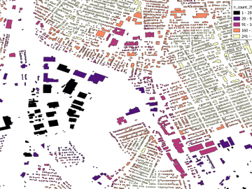
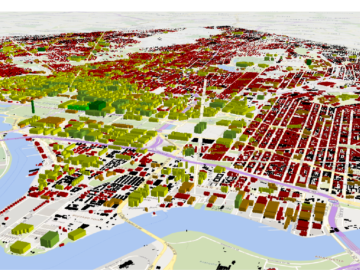
Researchers are using machine learning to provide a more complete picture of building geometries that include building height to within three meters of accuracy. This model not only provides building height for any building in the world, but it will also feed into LandScan and other large government datasets for planning and response.

Scientists and land managers interested in accessing the first dataset of its kind on one of the most biologically diverse ecosystems in the world were given hands-on tutorials during a recent workshop by researchers supporting the ORNL Distributed Active Archive Center for Biogeochemical Dynamics.
Scientists at ORNL have developed a first-ever urban heat wave simulation that takes into account the compounding effects from building infrastructure. The method provides a more accurate picture of the impacts from excessive heat on at-risk
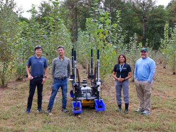
Scientists at the Department of Energy’s Oak Ridge National Laboratory recently demonstrated an autonomous robotic field monitoring, sampling and data-gathering system that could accelerate understanding of interactions among plants, soil and the environment.

In early November, ORNL hosted the International Atomic Energy Agency (IAEA) Interregional Workshop on Safety, Security and Safeguards by Design in Small Modular Reactors, which welcomed 76 attendees representing 15 countries, three U.S. national labs, domestic and international industry partners, as well as IAEA officers.

Joel Brogan, who leads the Multimodal Sensor Analytics group at Oak Ridge National Laboratory, has been elevated to senior membership in the Institute of Electrical and Electronics Engineers.

Using a best-of-nature approach developed by researchers working with the Center for Bioenergy Innovation at the Department of Energy’s Oak Ridge National Laboratory and Dartmouth University, startup company Terragia Biofuel is targeting commercial biofuels production that relies on renewable plant waste and consumes less energy. The technology can help meet the demand for billions of gallons of clean liquid fuels needed to reduce emissions from airplanes, ships and long-haul trucks.
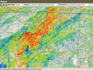
The ForWarn visualization tool was co-developed by ORNL with the U.S. Forest Service. The tool captures and analyzes satellite imagery to track impacts such as storms, wildfire and pests on forests across the nation.