
"These powerful network-based simulations can help predict the cascading impacts across critical infrastructure, especially during extreme events."
— Built Environment Characterization Group Leader Supriya Chinthavali
In May 2021, a cyberattack on the Colonial Pipeline Co. triggered soaring gas prices and shortages at East Coast gas pumps. Thanks to geospatial researchers at ORNL, the government understood how the pipeline shutdown affected crude flows and refinery operations.
But it couldn’t tell how shortages would play out at gas stations in specific regions. During some types of national disasters, that information could save lives.
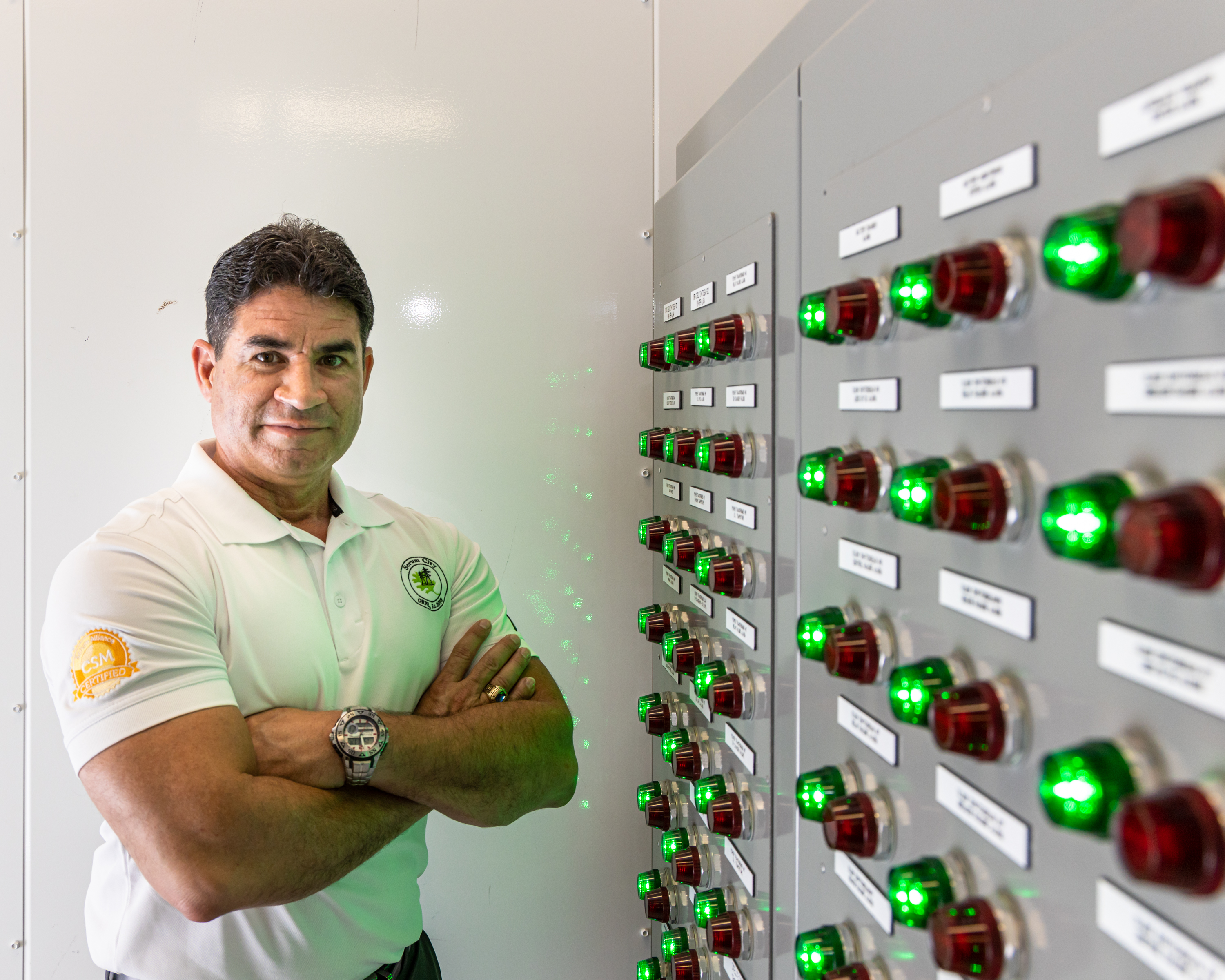
“During a hurricane event, if we expect people to evacuate, they need access to gasoline and diesel,” said Bandana Kar, who leads ORNL’s Built Environment Characterization Group. “We are developing models in collaboration with the National Energy Technology Laboratory to understand which gas stations are going to run out of fuel faster based on their capacity, location, supply and demand in the area.”
Disruptions to interconnected energy systems, whether caused by weather or attacks, are a major threat to national security. Resilient, robust energy infrastructure protects human life as well as the functions that underpin society, including health care, transportation and communications.
ORNL’s Geospatial Science and Human Security Division combines expertise in high-performance computing and geospatial science to provide decision-makers with timely information for rapid emergency response, disaster recovery and power restoration. ORNL data, tools and analysis support resource planning in case of large-scale outages caused by extreme events due to climate change.
“We are basically taking a broad view to understand on a daily basis: What is happening on the ground with regard to energy supply?” Kar said.
Understanding energy interdependencies
To support responses to future scenarios like the Colonial Pipeline attack, Kar and her colleagues have developed a supply chain model — the Situational-Temporal Awareness Tool for Integrated Oil and Natural Gas Systems, or STATIONS — that determines petroleum supplies all the way from refineries to fuel loading facilities to the pump, to help with petroleum demand during extreme events. Emergency responders and utilities can use the model to address resource planning.
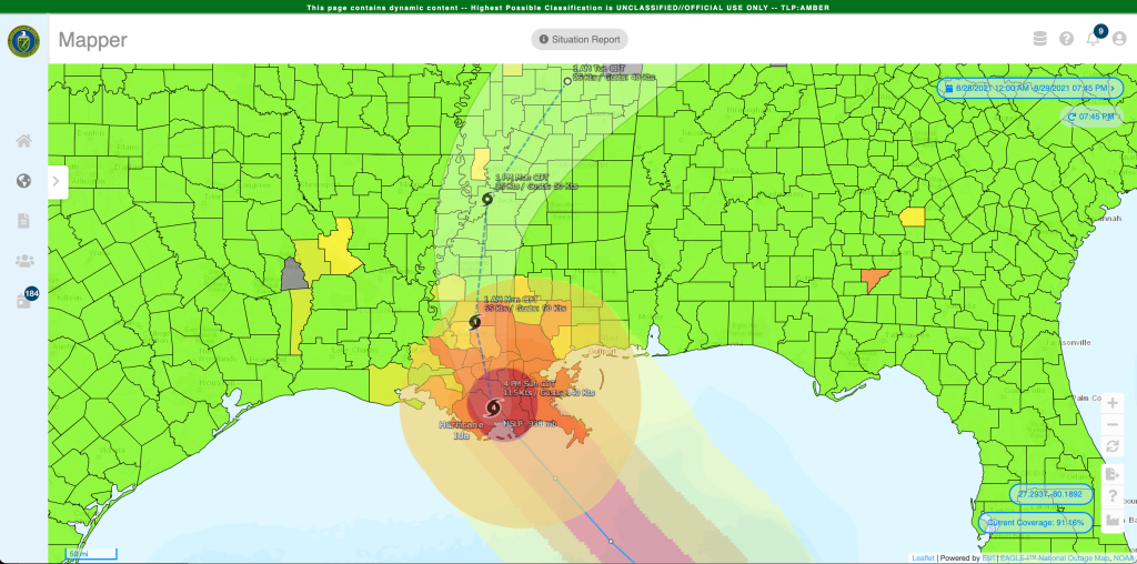
STATIONS results will be incorporated into a larger real-time situational awareness tool hosted by ORNL: the Environment for Analysis of Geo-located Energy Information, or EAGLE-I, a program in DOE’s Office of Cybersecurity, Energy Security, and Emergency Response. It is the authoritative federal source for monitoring energy infrastructure, reporting live outages, displaying potential threats, modeling to prepare for future scenarios and coordinating emergency response and recovery.
But oil and natural gas are just two U.S. energy resources, and they come from different sources and move through separate management and distribution networks. ORNL experts can integrate system status and supply chain information from oil, gas and electric systems to understand how those networks are intertwined.
For example, a hospital that loses electricity during an ice storm must then rely on diesel fuel to power its generators. This will lead to a spike in petroleum demand in the area. If the petroleum supply chain is unprepared, the hospital might struggle to find a gas station with the diesel needed to keep life-saving machines operating until electricity is restored.
URBAN-NET is a tool developed by ORNL scientists that represents these interdependencies in energy distribution as a networked graph, visually displaying vulnerabilities as analysts run different scenarios. URBAN-NET is also a component of EAGLE-I.
“These powerful network-based simulations can help predict the cascading impacts across critical infrastructure, especially during extreme events,” said Supriya Chinthavali, group leader for Geoinformatics Engineering. If a natural gas transmission line fails, for instance, which natural gas power plants will be at risk? What are the worst-case downstream results, such as widespread power outages or hospitals at risk?
New datasets and geospatial overlays can be added to understand the growing risk posed by developing hazards. For example, a severe drought could be layered onto the map, along with data about wildfire locations and National Weather Service warnings, to identify energy infrastructure facing the most stress, demand and risk.
— ORNL EAGLE-I Technical Lead Aaron Myers
Monitoring outages and restoring power
EAGLE-I delivers updates every 15 minutes on where outages are occurring and how many people are without power across the country. It plays a critical role for DOE in the National Response Framework, said Aaron Myers, ORNL EAGLE-I technical lead.
"EAGLE-I provides a national-scale situational awareness platform for sharing data across the energy sector,” Myers said. “Outputs from EAGLE-I have been used across various response efforts, and it has become a key application in the (national) response effort.”
But EAGLE-I doesn’t indicate how long the outages might last. Not all electricity companies report when they expect power to be restored, and no standardized format exists for those that do, Chinthavali said.
To address that problem, ORNL spearheaded the Outage Data Initiative Nationwide, or ODIN. Starting with a pilot program in Washington state, emergency management agencies, a handful of utilities and vendors worked toward standardized outage data reporting. Now more than 60 utilities report standardized outage information to ORNL, which collates the data into a map that enables power companies to quickly see both their own outages and those at neighboring utilities to help predict where backup crews might be available.
“ODIN enables utilities to be more efficient in restoring power through better management of mutual aid,” Chinthavali said.
Almost 10 years of EAGLE-I power outage data provides historical records that can be used to predict future outages and their lengths. This type of analysis could help federal agencies better support communities with a history of long outages, for example by preventing deaths when home medical devices stay shut down too long.
While this risk has been reduced as backup options have become more accessible, these resources still last for a limited time.
“Historically, after that, people start dying,” Chinthavali said. “It has happened so many times, especially during hurricanes. So it’s very important to estimate restoration times at the local level, to make sure the right help arrives in time to save people’s lives.” ORNL experts have begun working with the Federal Emergency Management Agency to develop a system for creating those estimates.
Advancing climate security and energy justice
U.S. agencies are increasingly recognizing and preparing for the ways climate change may affect national security, including risks to power distribution. Chinthavali’s team works with ORNL climate scientists to study the effect on energy infrastructure if climate change multiplies the effects of extreme weather events as expected, and it plan strategies for coping with these events. For instance, how would the grid deal with twice as many hurricanes? As we face more heat waves and wildfires, which areas are most likely to face rolling blackouts?
Kar said energy justice is likely to be an expanding challenge as climate change intensifies. For example, energy suppliers need to understand how climate-induced migration will shift energy demand, and which populations will face rolling blackouts because of extreme weather. EAGLE-I demographic and historical data could be used to identify communities that lack access to reliable power.
“We can see which areas are experiencing energy burden through longer and more frequent outages,” Kar said, “either because they are rural, or they have aging infrastructure, or they don’t have an alternate source of energy.”
When alternate energy sources are added to address these weaknesses, they need to be strategically placed on the grid. ORNL experts help electric utilities with this process through analysis of real-time power flow and load loss.
The challenges of distributed energy, the grid edge, energy justice, and climate change are expected to grow. ORNL scientists are preparing for them, as well as for unexpected disasters and attacks, to protect American security by keeping energy flowing.
Real-world impacts
ORNL’s critical infrastructure resilience tools and models have supported emergency response and energy restoration after many recent disasters:
- Colonial Pipeline ransomware attack
- California wildfires
- Extended electricity outages during 2021 Texas cold snap
- Redesign of Puerto Rican electricity infrastructure after Hurricane Maria
- Northeastern blizzards and ice storms
- Winter 2021 tornados and summer 2022 flooding in Kentucky
This story originally appeared as part of the national security story package in the Winter 2022 issue of the ORNL Review. See the other stories below or view the entire ORNL Review here.


