
Automation and security for geospatial data
Automation and security for geospatial data
Geographic data is critical to global situational awareness, navigation, and national defense. The Geomatics group enhances the utility and application of geospatial data by understanding and challenging fundamental spatial concepts at the data’s foundational limits.
Using technical expertise, researchers measure, process, and present geographic data including geodesy, photogrammetry, global positioning, navigation, and timing. The geomatics group is solving the automation and processing challenges required to deal with global scale high resolution data and is testing secure alternative timing required to harden our national infrastructure against spoofing and jamming.
Projects

Center for Alternative Synchronization and Timing (CAST)
Center for Alternative Synchronization and Timing (CAST)
The Center for Alternative Synchronization and Timing (CAST) at ORNL performs research, development, testing, evaluation, and technical assistance to enable resilient timing and synchronization. CAST was established in 2021 and is sponsored by DOE’s Office of Electricity.

Automating geopositioning
Automating geopositioning
Precision imaging validates the use of commercial and NTM satellite geolocation processes for use in Department of Defense applications. They are also working on automation for real-time geopositioning and automation of satellite image processing.
Titanium White
Titanium White
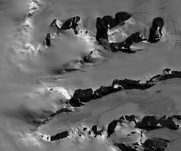
Titanium White is producing a global 2m terrain model. This terrain data is used in mobility models critical for tracking the assets of foreign competitors. It is also used for gravity modeling that affects the performance of satellite orbit predictions and maintenance of the global reference frames.
Securing the Nation with Better Geospatial Data
Expertise across the Geomatics team spans automatic image feature matching, satellite bundle adjustment and calibration, real-time geolocation, dense image matching, robust analysis, GNSS processing, hyper spectral imaging, navigation, alternative timing, lidar processing and spatial network modelling. The CAST teams consist of scientists and engineers specializing in PNT, network design, cybersecurity, signal processing and network operations.

Contact

Orrin Thomas, Geomatics Group Leader
View Orrin's staff profile
Orrin Thomas, Geomatics Group Leader