Developing Integrated Data and Analysis Tools
Scientists in the Remote Sensing and Environmental Informatics group at Oak Ridge National Laboratory explore Earth’s ecosystems through the development and application of integrated data and analysis tools. By combining observations from field-based studies with sophisticated airborne and satellite remote sensing technologies, and coupling these observations with advanced computational models, the group provides valuable insights into how ecosystems respond to environmental changes across the globe.
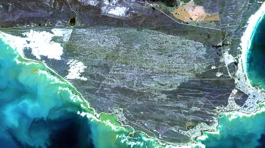
The group’s comprehensive approach bridges multiple scales of observation, ranging from ground-based measurements to expansive global datasets collected via satellite platforms. This multi-scale methodology enables researchers and policymakers to better understand ecosystem dynamics, assess environmental sensitivities and anticipate ecological responses under varying conditions. Central to the group’s mission is delivering integrated data products, streamlined data management systems and intuitive data delivery services that facilitate impactful research, education, and environmental decision-making.
The team possesses deep expertise spanning remote sensing, ecology, biogeochemistry, Earth system science, hydrology, and related disciplines. This interdisciplinary expertise allows the team to tackle complex scientific questions with a holistic perspective. Additionally, skilled developers, data scientists, information specialists, and environmental modelers are integral members, contributing to the classification, management, dissemination, integration, and visualization of extensive environmental datasets. The collaborative synergy within this team ensures efficient translation of data into actionable knowledge.
A cornerstone of the group’s capabilities is the ORNL Distributed Active Archive Center (ORNL DAAC) funded by NASA. ORNL DAAC is a crucial component of NASA’s Earth Observing System Data and Information System (EOSDIS), managed by NASA’s Earth Science Data and Information System (ESDIS) Project. This center provides open access to critical ecological and biogeochemical data generated through NASA Earth Science Missions. Responsibilities of the ORNL DAAC include meticulous data archival, innovative product development, broad data distribution, and comprehensive user support, ensuring global accessibility and usability of essential datasets.
The group contributes significantly to environmental science, providing the data-driven tools and analytical frameworks necessary to enhance ecological research, inform effective policy, and address pressing environmental challenges.
Researchers













Publications
Sep, 2026
Journal
Small Reservoirs Offer a New Perspective on Flood Reduction in Large Basins
The flood reduction potential of individual reservoirs within a large river network continuum remains poorly understood due to the complex interplay between reservoir characteristics and network properties. Here we investigate whether a collection of relatively small reservoirs can play a significant role in mediating downstream floods and assess how that role may be influ…
Jul, 2026
Journal
Sedimentation and Nonlinear Trapping in Texas Reservoirs Identified Using Remote Sensing and Bathymetric Survey Records
Decreasing reservoir storage capacity due to sedimentation poses great challenges to aging U.S. reservoirs, as it reduces the efficacy and reliability of their socio‐economic services. However, systematic assessments of reservoir sedimentation rates and associated issues remain limited because of sparse and infrequent bathymetry survey data. In this study, we use remote se…
Contact