In combating the climate crisis, scientists are working to better understand emissions sources and the factors that influence them with a view toward crafting potential mitigation strategies.
Achieving a clearer picture of emission rates starts with gathering more data. Emissions vary widely with season, geography, reservoir operations and a changing climate. They are affected by many factors, including temperature, algae growth and the depth and flow of waters.
Emissions are sensitive to natural and human-driven changes such as nutrient pollution, droughts and storms. Releasing water from reservoirs for flood control, irrigation, hydropower generation and recreation also affects emission rates.
All inland waterways emit carbon dioxide and methane.
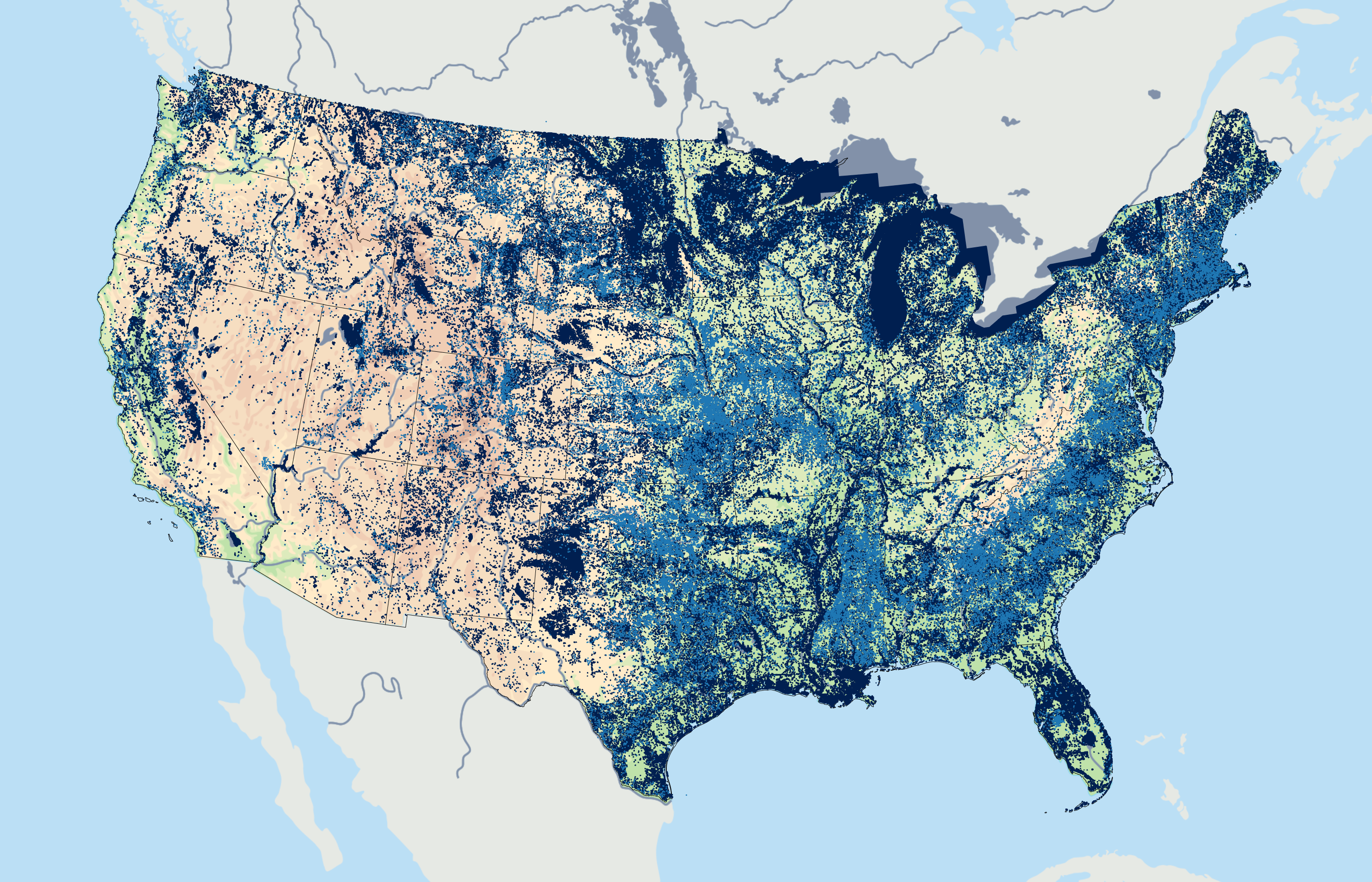
Most of the methane emissions come from shallow areas in lakes and reservoirs.
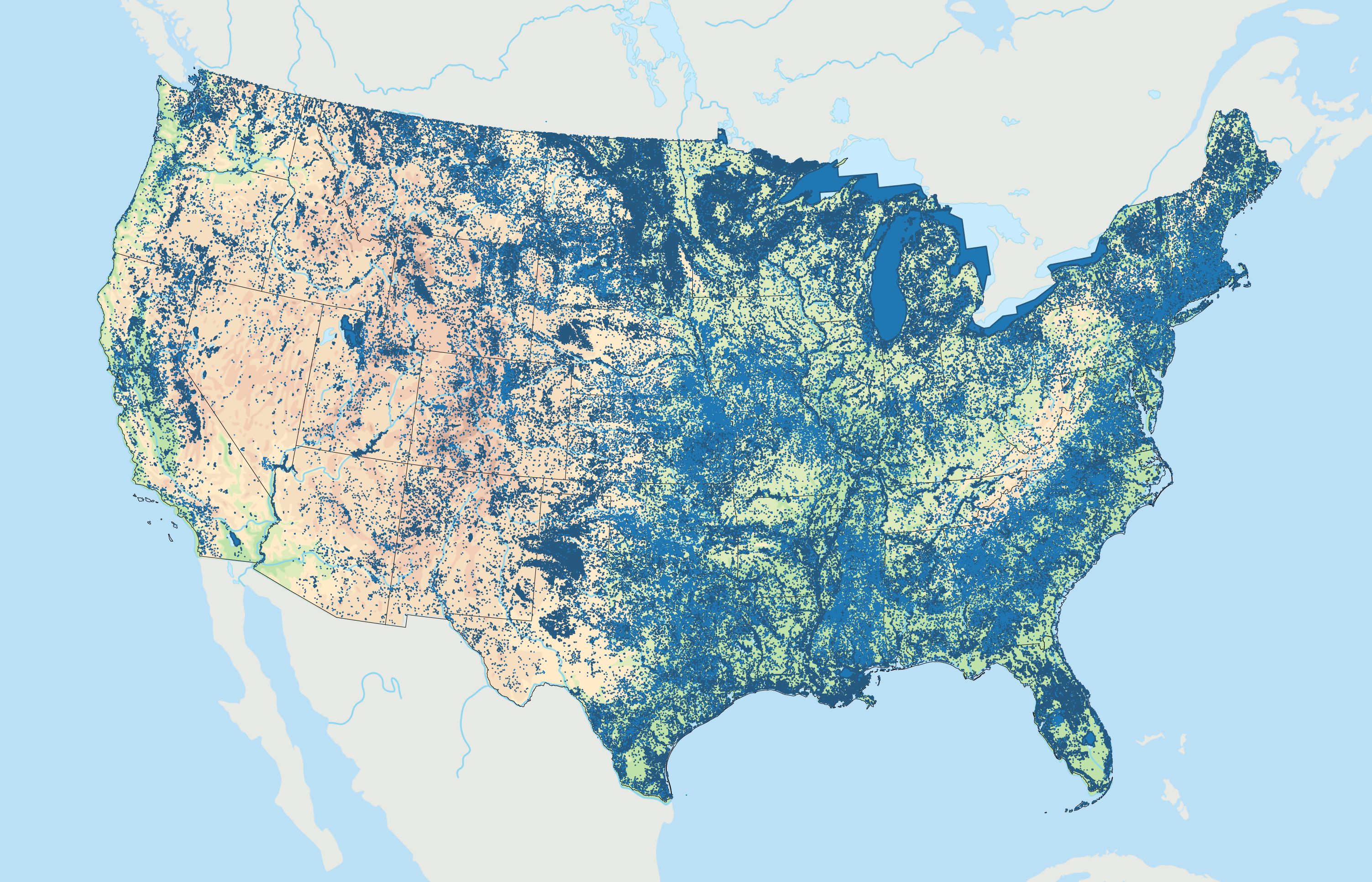
Across the United States, there are more than 90,000 dams. Many of these dams store water in reservoirs for flood control, irrigation, water supply or generating electricity.


Fewer than 3% of those dams are powered.
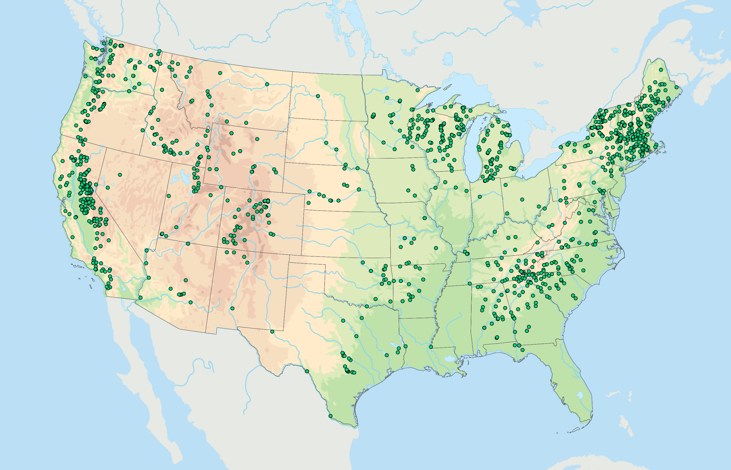
Data on emissions are only available for a handful of hydropower reservoirs, and many of those data are incomplete.
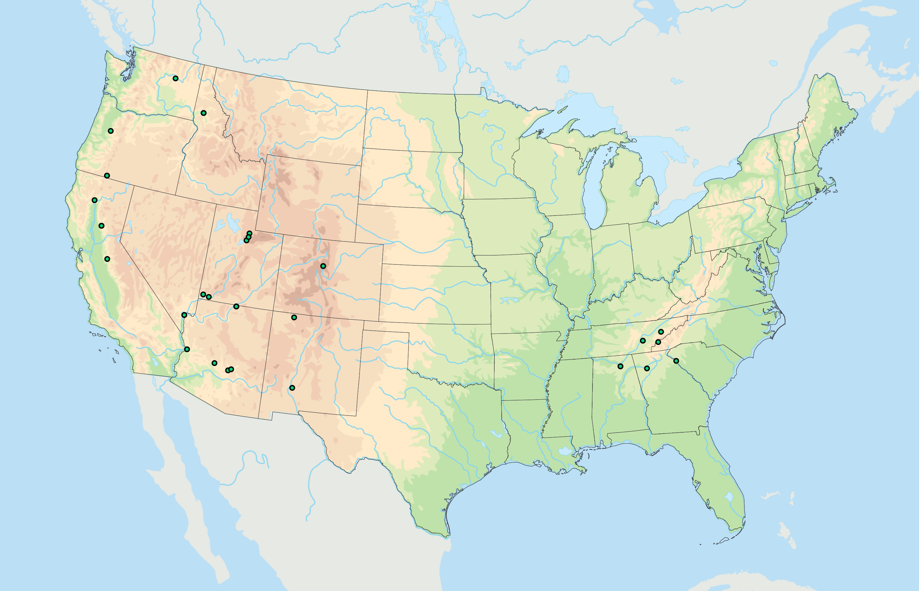
The sparse data and the variability of reservoir levels, temperatures and algae growth make it difficult to use models to predict potential emissions. That’s why ORNL scientists are collecting key data from reservoirs in five Southeastern states.
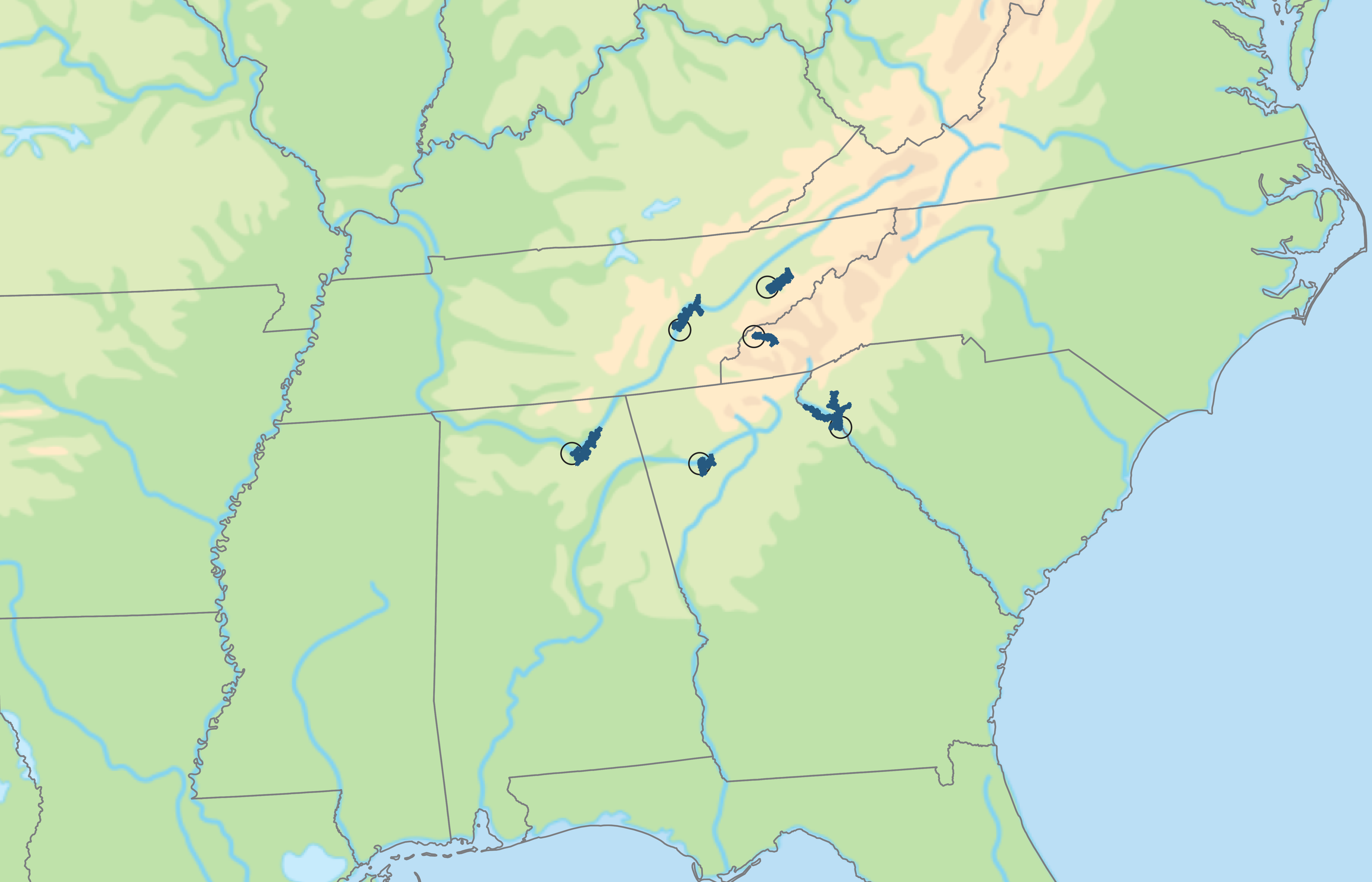

The ORNL study is one of the first to measure all three emission pathways simultaneously. The team’s recent sampling campaigns showed high variability in emissions over time both within a reservoir and across different reservoirs.

The findings show that in the summer, the sampled reservoirs act as carbon sinks – absorbing carbon dioxide from the atmosphere – mostly due to algae growth. In the spring and fall, the reservoirs become carbon sources.

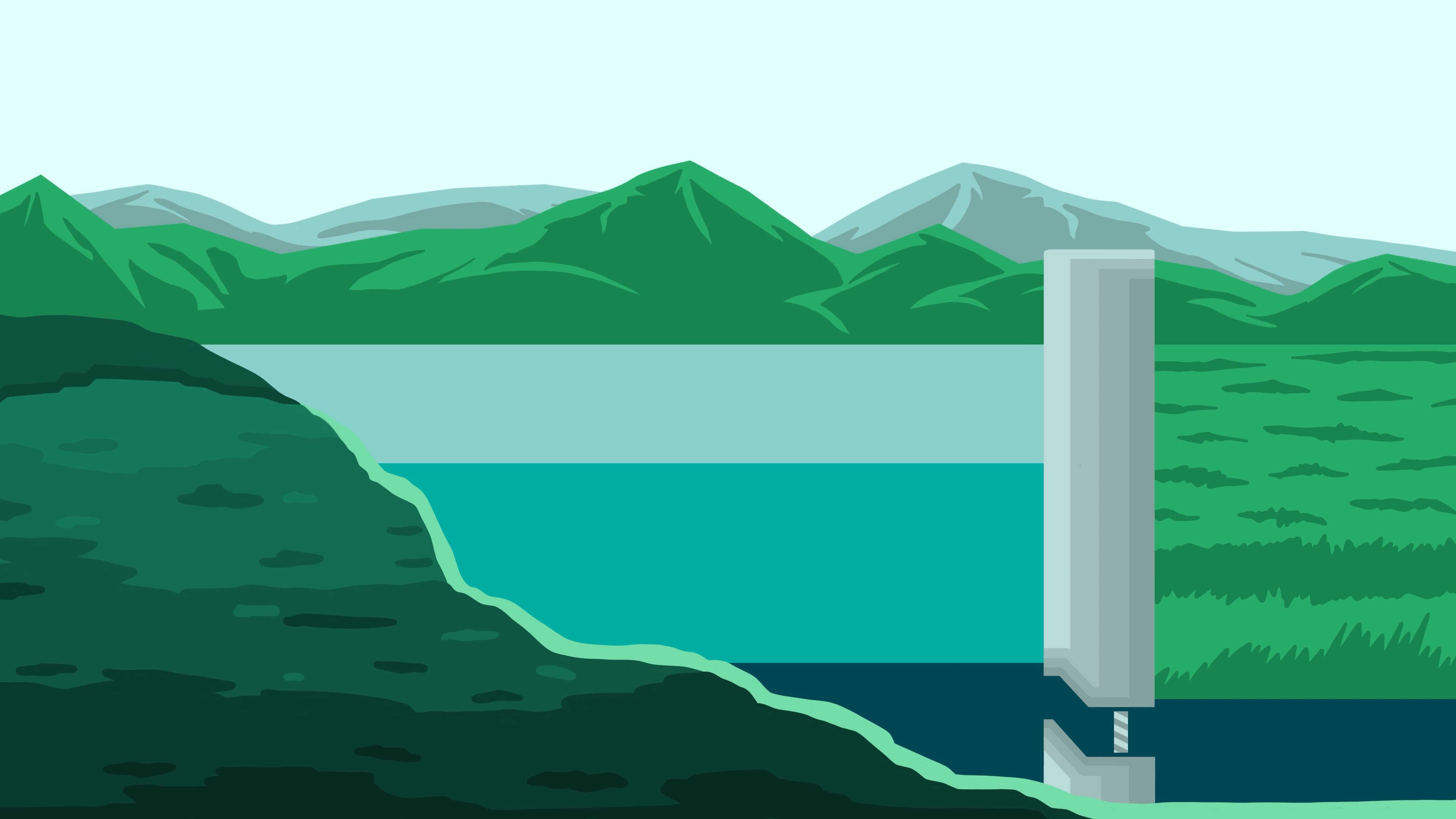
An important factor affecting emissions on seasonal timescales is reservoir operations, such as release of water for flood control, that reduce lake levels and surface area. Lower lake levels create shallow zones where methane can more easily bubble to the surface.
Reservoir geometry along with seasonal changes in the layers of temperatures, known as thermal stratification, in each waterbody also strongly influence emission rates.
The cooler denser waters at the bottom of the lake often contain no dissolved oxygen, allowing methane to build up as microbes break down organic matter in the lakebed. If this methane-rich water is pulled through deep-water intakes, methane is released as water exits the dam.
Credits
Principal Investigator: Natalie Griffiths
Story by: Kim Askey
Design: Laddy Fields
Animation: Jacquelyn DeMink
Map Illustrations: Andy Sproles and Carly Hansen
Photography: Carlos Jones and Scott DeNeale
Drone Videography: Kase Clapp and Genevieve Martin
Development: Cynthia Latham, David Mandeville and Jesse Wolfe
Project Managers: Brad Greenfield, Brittany Cramer and Morgan McCorkle