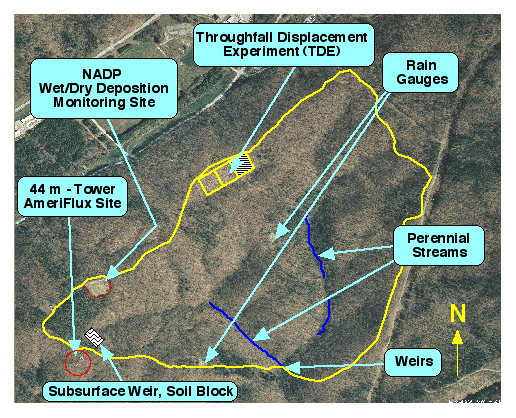
This page contains aerial photographs for the Walker Branch Watershed research area from 1924 through 1998. The following image shows the location of the TDE experiment and other research facilities on Walker Branch Watershed for comnparson to the subsequent aerial photographs.
Aerial Photographs
The gif images will show up in the web browser window, but the tif images will be downloaded to your computere desktop if desired.