


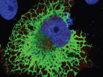
Oak Ridge National Laboratory scientists exploring bioenergy plant genetics have made a surprising discovery: a protein domain that could lead to new COVID-19 treatments.
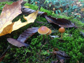
Oak Ridge National Laboratory and collaborators have discovered that signaling molecules known to trigger symbiosis between plants and soil bacteria are also used by almost all fungi as chemical signals to communicate with each other.
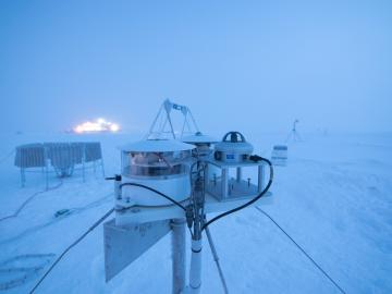
Researchers at Oak Ridge National Laboratory were part of an international team that collected a treasure trove of data measuring precipitation, air particles, cloud patterns and the exchange of energy between the atmosphere and the sea ice.
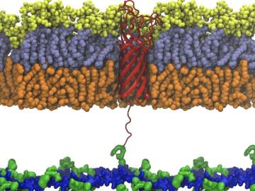
Scientists from Oak Ridge National Laboratory used high-performance computing to create protein models that helped reveal how the outer membrane is tethered to the cell membrane in certain bacteria.

Oak Ridge National Laboratory’s high-resolution population distribution database, LandScan USA, became permanently available to researchers in time to aid the response to the novel coronavirus pandemic.

A novel approach developed by scientists at ORNL can scan massive datasets of large-scale satellite images to more accurately map infrastructure – such as buildings and roads – in hours versus days.

Gleaning valuable data from social platforms such as Twitter—particularly to map out critical location information during emergencies— has become more effective and efficient thanks to Oak Ridge National Laboratory.