Researchers used the open-source Community Earth System Model to simulate the effects that extreme climatic conditions have on processes like land carbon storage. Credit: Carlos Jones/ORNL, U.S. Dept. of Energy

Researchers from Oak Ridge National Laboratory and Northeastern University modeled how extreme conditions in a changing climate affect the land’s ability to absorb atmospheric carbon — a key process for mitigating human-caused emissions. They found that 88% of Earth’s regions could become carbon emitters by the end of the 21st century. 

The TRITON model provides a detailed visualization of the flooding that resulted when Hurricane Harvey stalled over Houston for four days in 2017. Credit: Mario Morales-Hernández/ORNL, U.S. Dept. of Energy

A new tool from Oak Ridge National Laboratory can help planners, emergency responders and scientists visualize how flood waters will spread for any scenario and terrain.

Diverse evidence shows that plants and soil will likely capture and hold more carbon in response to increasing levels of carbon dioxide in the atmosphere, according to an analysis published by an international research team led by Oak Ridge National Laboratory.

Diverse evidence shows that plants and soil will likely capture and hold more carbon in response to increasing levels of carbon dioxide in the atmosphere, according to an analysis

Pine trees in the Tuolumne Valley of Yosemite National Park show the effects of drought and fire. Credit: Anthony Walker/Oak Ridge National Laboratory, U.S. Dept. of Energy

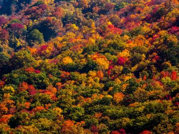
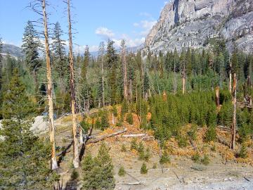
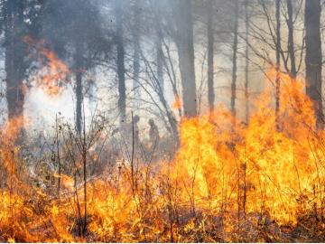
A multi-institutional research team found that changing environmental conditions are affecting forests around the globe, leading to increasing tree death and uncertainty about the ability of forests to recover.

A new computational approach by ORNL can more quickly scan large-scale satellite images, such as these of Puerto Rico, for more accurate mapping of complex infrastructure like buildings. Credit: Maxar Technologies and Dalton Lunga/Oak Ridge National Laboratory, U.S. Dept. of Energy

A novel approach developed by scientists at ORNL can scan massive datasets of large-scale satellite images to more accurately map infrastructure – such as buildings and roads – in hours versus days. 

Heat impact map

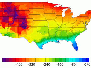
A detailed study by Oak Ridge National Laboratory estimated how much more—or less—energy United States residents might consume by 2050 relative to predicted shifts in seasonal weather patterns 

Researchers used machine learning methods on the ORNL Compute and Data Environment for Science, or CADES, to map vegetation communities in the Kougarok Watershed on the Seward Peninsula of Alaska. The colors denote different types of vegetation, such as w

A team of scientists led by Oak Ridge National Laboratory used machine learning methods to generate a high-resolution map of vegetation growing in the remote reaches of the Alaskan tundra.