

The Department of Energy’s Oak Ridge National Laboratory announced the establishment of the Center for AI Security Research, or CAISER, to address threats already present as governments and industries around the world adopt artificial intelligence and take advantage of the benefits it promises in data processing, operational efficiencies and decision-making.

U2opia Technology, a consortium of technology and administrative executives with extensive experience in both industry and defense, has exclusively licensed two technologies from ORNL that offer a new method for advanced cybersecurity monitoring in real time.

A partnership of ORNL, the Tennessee Department of Economic and Community Development, the Community Reuse Organization of East Tennessee and TVA that aims to attract nuclear energy-related firms to Oak Ridge has been recognized with a state and local economic development award from the Federal Laboratory Consortium.
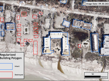
Over the past seven years, researchers in ORNL’s Geospatial Science and Human Security Division have mapped and characterized all structures within the United States and its territories to aid FEMA in its response to disasters. This dataset provides a consistent, nationwide accounting of the buildings where people reside and work.
ORNL scientists will present new technologies available for licensing during the annual Technology Innovation Showcase. The event is 9 a.m. to 3 p.m. Thursday, June 16, at the Manufacturing Demonstration Facility at ORNL’s Hardin Valley campus.

A developing method to gauge the occurrence of a nuclear reactor anomaly has the potential to save millions of dollars.

Oak Ridge National Laboratory researchers have discovered a better way to separate actinium-227, a rare isotope essential for an FDA-approved cancer treatment.
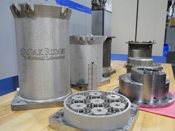
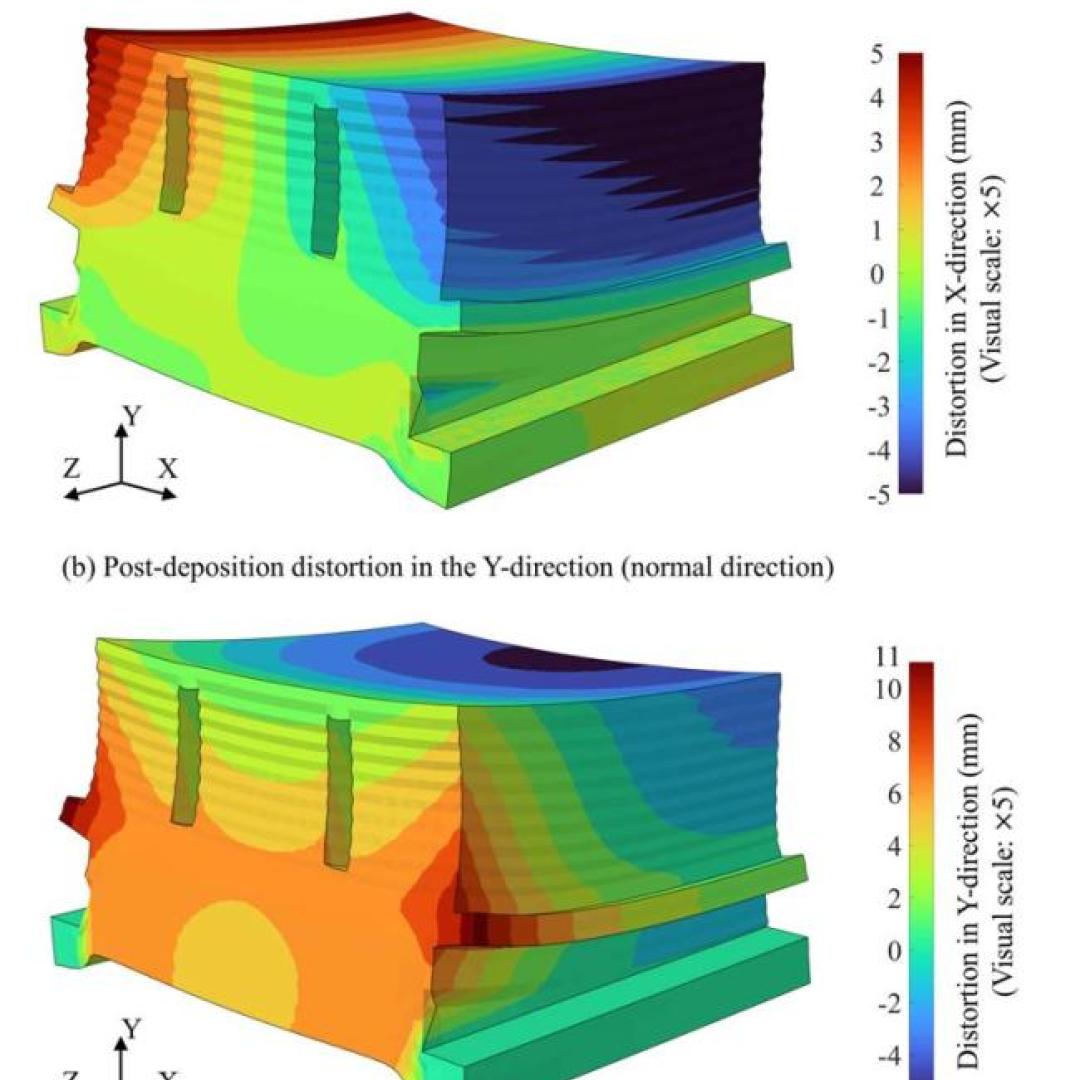
Researchers at the Department of Energy’s Oak Ridge National Laboratory are refining their design of a 3D-printed nuclear reactor core, scaling up the additive manufacturing process necessary to build it, and developing methods
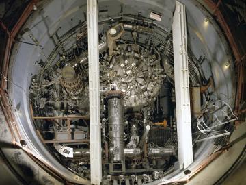
In the 1960s, Oak Ridge National Laboratory's four-year Molten Salt Reactor Experiment tested the viability of liquid fuel reactors for commercial power generation. Results from that historic experiment recently became the basis for the first-ever molten salt reactor benchmark.

A novel approach developed by scientists at ORNL can scan massive datasets of large-scale satellite images to more accurately map infrastructure – such as buildings and roads – in hours versus days.