


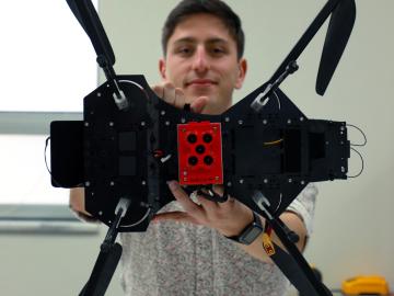
Jack Orebaugh, a forensic anthropology major at the University of Tennessee, Knoxville, has a big heart for families with missing loved ones. When someone disappears in an area of dense vegetation, search and recovery efforts can be difficult, especially when a missing person’s last location is unknown. Recognizing the agony of not knowing what happened to a family or friend, Orebaugh decided to use his internship at the Department of Energy’s Oak Ridge National Laboratory to find better ways to search for lost and deceased people using cameras and drones.

Digital twins are exactly what they sound like: virtual models of physical reality that continuously update to reflect changes in the real world.
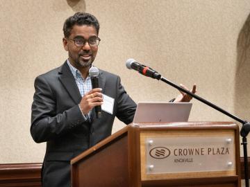
The Department of Energy’s Oak Ridge National Laboratory hosted its Smoky Mountains Computational Science and Engineering Conference for the first time in person since the COVID pandemic broke in 2020. The conference, which celebrated its 20th consecutive year, took place at the Crowne Plaza Hotel in downtown Knoxville, Tenn., in late August.
When geoinformatics engineering researchers at the Department of Energy’s Oak Ridge National Laboratory wanted to better understand changes in land areas and points of interest around the world, they turned to the locals — their data, at least.
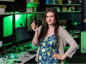
Tristen Mullins enjoys the hidden side of computers. As a signals processing engineer for ORNL, she tries to uncover information hidden in components used on the nation’s power grid — information that may be susceptible to cyberattacks.
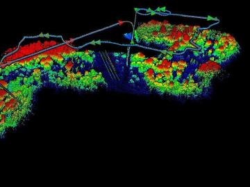
The Autonomous Systems group at ORNL is in high demand as it incorporates remote sensing into projects needing a bird’s-eye perspective.
In human security research, Thomaz Carvalhaes says, there are typically two perspectives: technocentric and human centric. Rather than pick just one for his work, Carvalhaes uses data from both perspectives to understand how technology impacts the lives of people.

When Matt McCarthy saw an opportunity for a young career scientist to influence public policy, he eagerly raised his hand.
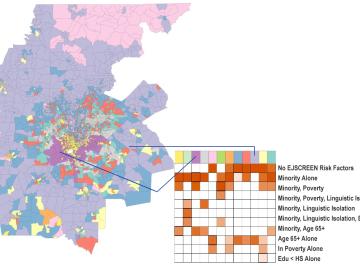
Scientists develop environmental justice lens to identify neighborhoods vulnerable to climate change
A new capability to identify urban neighborhoods, down to the block and building level, that are most vulnerable to climate change could help ensure that mitigation and resilience programs reach the people who need them the most.

It’s a simple premise: To truly improve the health, safety, and security of human beings, you must first understand where those individuals are.